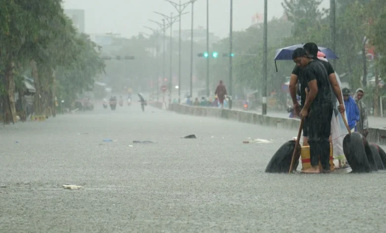
Meteorological authorities across Vietnam have issued urgent, high-level weather warnings as a complex convergence of tropical disturbances, active monsoonal flows, and early-season cold air masses converge to trigger torrential rainfall across multiple regions. The severe weather system, which intensified significantly around mid-September, has placed central provinces—as well as parts of the northern and southern regions—on high alert for catastrophic downpours, localized urban flooding, flash floods, and severe convective storms.
The unfolding meteorological event underscores the heightened volatility of regional weather patterns, posing profound challenges to local infrastructure, agricultural yields, and public safety. As meteorological experts monitor the continuous development of a low-pressure area over the East Sea, communities from Ha Tinh down to Quang Ngai, alongside the Central Highlands and major urban hubs like Ho Chi Minh City, are bracing for prolonged hazardous conditions.
Widespread Torrential Rains Grip Central Vietnam
Heavy downpours began sweeping across the central corridor of Vietnam on September 11, profoundly impacting the stretch from Ha Tinh province down to the major urban center of Da Nang. According to official recordings from the National Center for Hydro-Meteorological Forecasting (NCHMF), massive precipitation accumulations were documented during a brief evaluation window between 7:00 AM and 3:00 PM on the same day. Several meteorological stations registered localized accumulations exceeding 100 millimeters. Notably, the Dau Lieu station in Ha Tinh recorded 102 millimeters, while the mountainous Bach Ma peak in Thua Thien Hue province—historically one of the wettest zones in the country—measured an astonishing 137.2 millimeters within just a few hours.
Meteorologists have forecasted that the severe precipitation event will persist through September 12, with the core of the heavy rainfall shifting and intensifying across the region stretching from Ha Tinh to Da Nang, as well as eastern Quang Ngai. General rainfall totals during this intensive phase are widely expected to range between 50 and 100 millimeters. However, extreme outliers in certain districts could surpass the 200-millimeter threshold.
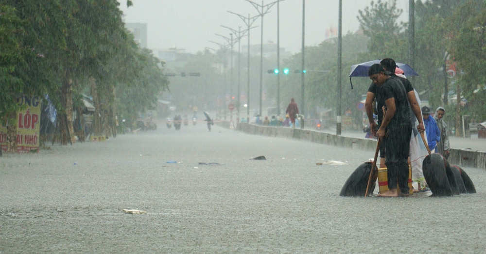
The situation is expected to be particularly acute between Hue and Da Nang, where baseline accumulations of 70 to 150 millimeters are anticipated, and isolated pockets could see rainfall totals surge past 250 millimeters. Concurrently, the eastern sections of the Central Highlands provinces, stretching from Gia Lai down to Dak Lak, alongside regional parts of southern Vietnam, are experiencing active thunderstorms accompanied by sustained rainfall totals of 30 to 60 millimeters, with localized extremes topping 100 millimeters.
Detailed Meteorological Chronology and Evolution
The progression of this weather anomaly follows a clearly defined, multi-day timeline dictated by shifting atmospheric dynamics.
Starting from the afternoon and extending into the evening of September 11, the convergence zone began anchoring itself firmly over the central coastline. Weather experts noted that from the night of September 11 through the early morning of September 12, the municipalities of Da Nang and Hue, alongside southern Quang Tri and northern Quang Ngai, bore the brunt of the most severe downpours. These intense conditions have shown a persistent tendency to stall, lingering throughout the daylight hours of September 12 and threatening to extend their impact into September 13.
As the system matures, a secondary phase is projected to unfold between September 12 and September 13. During this window, the heaviest rainfall will concentrate intensely from Ha Tinh down to Da Nang, where continuous downpours of 70 to 150 millimeters—and locally over 250 millimeters—will elevate environmental stress to critical levels.
By September 13, the northern perimeter of the weather system will expand its reach. Thanh Hoa, Nghe An, and the eastern districts of Quang Ngai will face moderate to heavy rains accompanied by thunderstorms, bringing general totals of 20 to 40 millimeters, with isolated peaks exceeding 70 millimeters. Furthermore, weather models indicate that the broader atmospheric disturbance could maintain its grip on parts of the country until the morning of September 16, presenting a prolonged hazard window for emergency responders and vulnerable populations.
Complex Atmospheric Drivers Behind the Extreme Weather
To understand the severity of this widespread meteorological event, climate scientists and forecasters have pointed to a rare combination of simultaneous synoptic-scale drivers. The primary catalyst is the active interaction between a southward-shifting tropical convergence zone, the prevailing southwest monsoon, and supplementary atmospheric phenomena.
According to analyses provided by meteorological institutes, the active tropical convergence zone currently stretches roughly between 13 and 16 degrees North latitude, seamlessly linking with a developing low-pressure area situated over the central waters of the East Sea. This setup creates an atmospheric conveyor belt of moisture and instability.
Compounding this dynamic is the rear circulation of a tropical high-pressure system, which has been exhibiting a distinct westward migration. This movement establishes robust easterly wind vectors in the upper troposphere, which directly impact the central coast of Vietnam. These upper-level easterlies act as a forced lifting mechanism, squeezing moisture out of the humid air masses brought ashore by the southwest monsoon and tropical convergence zone, thereby exponentially amplifying rainfall intensities.
Dr. Nguyen Ngoc Huy, a prominent climate change and disaster mitigation expert, provided critical context regarding the localized behavior of the storm system. He observed that the heavy precipitation recorded across central regions possesses extreme instantaneous intensity, with radar models showing rainfall rates frequently touching 20 to 25 millimeters per hour. When sustained over multiple consecutive hours, this rate of water delivery quickly overwhelms standard drainage capacities, turning urban streets into torrents and elevating the risk of sudden environmental hazards.
Urban Vulnerability and Flash Flood Risks in Major Hubs
The threat profile of the current weather pattern extends far beyond rural and mountainous zones, posing acute risks to major metropolitan areas, most notably Da Nang and Hue.

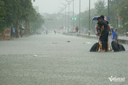
Dr. Huy noted that while the peak of the heavy rainfall has concentrated predominantly in the eastern sectors of Da Nang and Hue, the current water levels in upstream western reservoirs remain relatively low. This specific hydrological detail substantially mitigates the immediate threat of catastrophic downstream flooding originating from major river basin releases. However, the localized accumulation of high-intensity rainfall directly over urban environments creates an entirely different category of hazard: flash flooding from localized downpours and severe urban waterlogging.
Of particular concern to disaster management officials are specific low-lying urban pockets within Da Nang that suffered severe, prolonged submergence during the historic flood event on October 14, 2022. Because the ongoing system is capable of generating persistent hourly downpours of 20 to 25 millimeters, neighborhoods situated in these historical bowl-like depressions are at immediate risk of recurring inundation.
"In low-lying areas that are prone to localized flooding driven by intensive downpours—characterized by relatively clear runoff water—residents must take proactive measures," Dr. Huy advised. "Households should immediately elevate valuable belongings, electrical appliances, and furniture, and refrain from parking vehicles in low-lying alleyways or subterranean parking structures prone to rapid water accumulation."
In addition to urban waterlogging, mountainous and sloping terrain across the central provinces faces severe threats from flash floods along small streams and devastating landslides along steep hillsides. Soil saturation has reached critical limits due to previous seasonal rains, meaning that even moderate additional rainfall can trigger slope failures without warning.
Extension of Severe Weather to Northern and Southern Regions
While the central corridor absorbs the primary blow of the tropical disturbance, the rest of the country is not insulated from the sprawling weather system.

The NCHMF has issued specific warnings indicating that due to the persistent influence of the tropical convergence zone—which is actively drifting northward and potentially consolidating into a tropical depression or storm over the East Sea—the northern regions will also experience significant meteorological disruption. Between September 13 and September 14, the midlands and lowland plains of Northern Vietnam, along with the southern parts of Son La, Tuyen Quang, and Lao Cai provinces, are projected to encounter moderate to heavy rains and thunderstorms. Rainfall accumulations in these areas are forecast to range between 30 and 70 millimeters, with localized extremes surpassing 120 millimeters.
Concurrently, the axis of heavy precipitation will shift back to focus heavily on the corridor from Thanh Hoa to Quang Trinh, where cumulative totals of 100 to 200 millimeters—and isolated spots exceeding 300 millimeters—will challenge local flood defenses.
Simultaneously, peripheral regions such as Thanh Hoa, Nghe An, Khanh Hoa, and eastern Lam Dong have experienced scattered rain showers and thunderstorms, producing daily averages of 10 to 30 millimeters, with localized heavy bursts exceeding 70 millimeters. Meteorological authorities emphasize that these thunderstorms carry inherent severe weather risks, including lightning strikes, damaging hail, and powerful wind gusts capable of tearing roofs off temporary structures and uprooting trees.
The southern region, including Ho Chi Minh City, has also been grappling with compounding severe weather challenges. Following an exceptionally rare and violent deluge accompanied by relentless lightning that severely inundated numerous residential neighborhoods and paralyzed traffic across multiple districts, southern residents have been forced to mobilize pumps and don waterproof gear to clean up flood damages. Meteorological forecasts indicate that southern Vietnam will continue to experience unsettled weather, with widespread showers and intermittent heavy to very heavy downpours persisting in the coming days.
Socioeconomic Implications and Disaster Preparedness
The convergence of early-season cold air masses from the north and active tropical low-pressure systems over the East Sea highlights the transitional nature of Vietnam’s climate as it moves deeper into the stormy autumn season. These transitional periods are historically associated with some of the country’s most destructive natural disasters, as temperature gradients and moisture supplies reach optimal conditions for rapid convective development.

Emergency management committees across the affected provinces have activated heightened response protocols. Local authorities have been instructed to continuously monitor reservoir safety, maintain constant communication with vulnerable coastal communities, and prepare evacuation plans for residents living in high-risk landslide and flash flood zones. Search and rescue teams, along with medical supplies and emergency food stocks, have been pre-positioned in critical districts to ensure rapid response capabilities should communication lines or transport links be severed by rising waters.
Agricultural sectors are also bracing for potential losses. Prolonged inundation in low-lying farming regions threatens unharvested crops, aquaculture facilities, and livestock. Extension workers have been deployed to advise farmers on drainage acceleration techniques and early harvesting methods wherever feasible to minimize economic damage.
As the meteorological situation remains fluid and highly unpredictable, national forecasting agencies continue to issue real-time updates and localized alerts. Residents across the central, northern, and southern provinces are strongly advised to closely monitor official weather bulletins, limit unnecessary travel through flooded or mountainous zones during peak storm hours, and strictly adhere to directives issued by local civil defense authorities.