Blind Trust in Navigation Apps Lands Drivers with Heavy Fines for Inadvertent Wrong-Way Travel on Expressway Service Roads

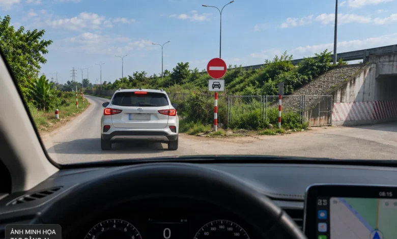
Relying on digital mapping applications like Google Maps to navigate unfamiliar territories has become an indispensable habit for millions of drivers worldwide. While these technological tools generally excel at optimizing routes and bypassing congestion, an over-reliance on automated guidance systems can sometimes yield severe consequences. In Vietnam, a growing number of motorists traveling from southern provinces toward Hanoi have fallen victim to a navigational trap near the Phù Xuyên underpass along the Pháp Vân – Cầu Giẽ expressway. Blindly following digital routing instructions during peak holiday travel periods has led drivers straight into restricted zones, resulting in staggering financial penalties and points deducted from their driver’s licenses.
The Navigation Trap Unfolds During Peak Holiday Traffic
The phenomenon gained widespread attention following the conclusion of the five-day National Day holiday period on September 2. To circumvent anticipated traffic congestion on National Highway 1A, numerous motorists traveling north from provinces such as Thanh Hóa chose to exit the expressway and utilize alternative local routes. Among them was Mr. Lương Anh Huy, a resident of Đống Đa district, Hanoi, who drove his KIA K3 back from Thanh Hóa. Unfamiliar with the intricacies of the local road network, Mr. Huy activated both Google Maps for route guidance and Vietmap to monitor speed limits and traffic signs.
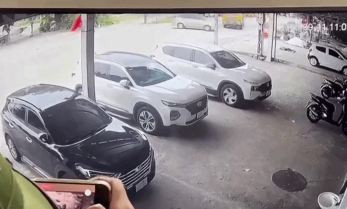
As Mr. Huy approached the Phù Xuyên area, Google Maps directed him to exit the main expressway and navigate through the local underpass to utilize the service road running parallel to the Pháp Vân – Cầu Giẽ expressway, with the eventual intention of rejoining the main highway closer to Hanoi. Trusting the digital prompt, he turned left into the service road. However, upon completing the turn, he was startled to find his vehicle moving against the primary flow of traffic on the adjacent expressway corridor.
Despite the alarming realization, the presence of a dashed yellow centerline on the roadway created a false sense of security, leading him to believe the lane might accommodate two-way traffic. Shortly after proceeding further down the stretch, he encountered official traffic restriction signs, leaving him confused and stranded before traffic police intercepted his vehicle.
Similar Experiences Shared by Multiple Motorists
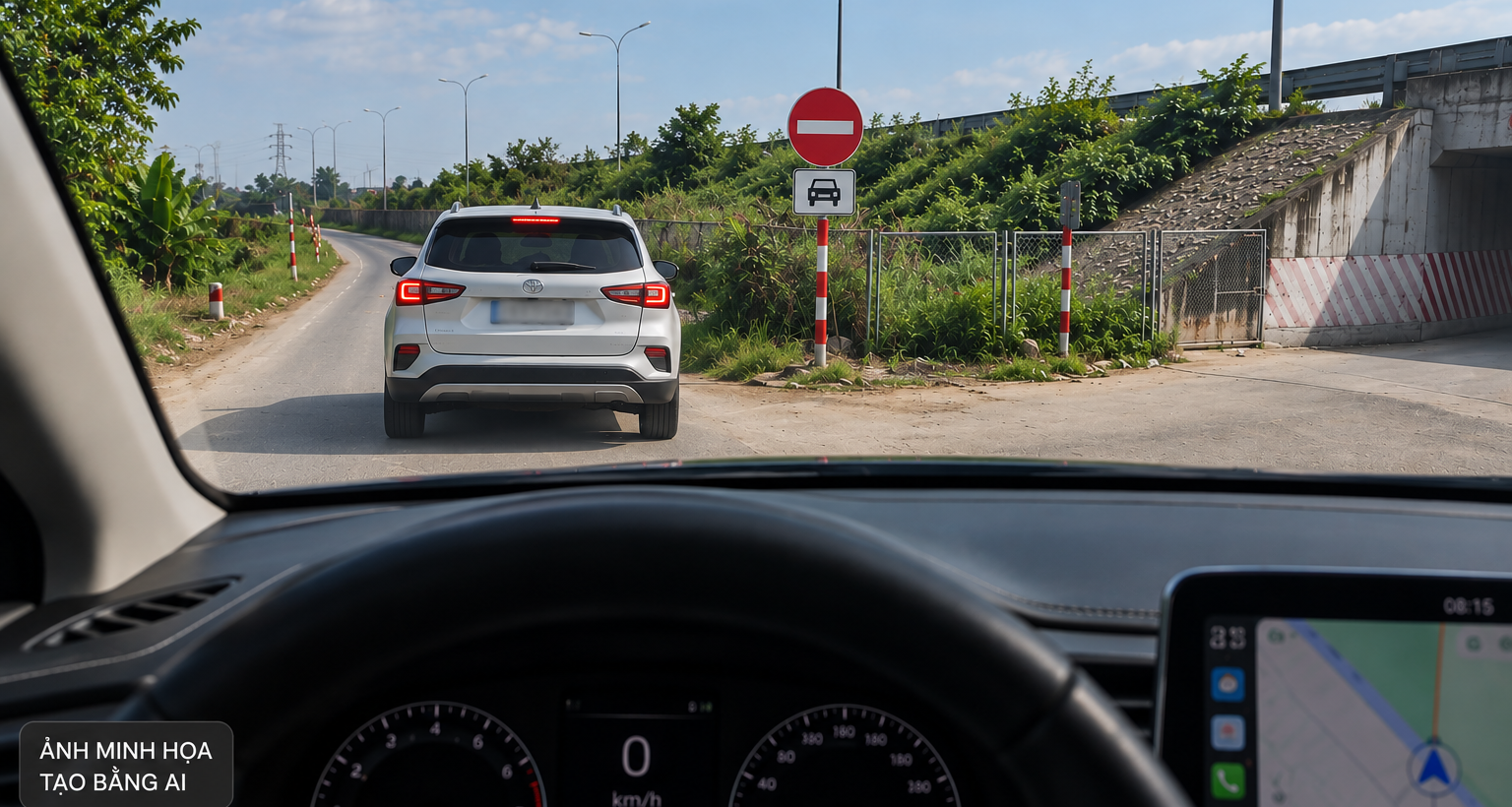
Mr. Huy was not an isolated case. Mr. Anh Minh, another Hanoi-based motorist driving a Mazda, encountered the exact same navigational error under nearly identical circumstances on the same day. Having driven approximately 300 kilometers, Mr. Minh relied entirely on Google Maps after encountering heavy holiday congestion. The application diverted him onto the minor service road near Cầu Giẽ, only for him to discover too late that the route was restricted to oncoming traffic.
According to Mr. Minh, he parked his vehicle near the intersection for approximately 15 minutes to observe the traffic flow and discovered that nearly a dozen other cars had similarly wandered into the restricted zone within that brief window. Many of these drivers were returning from central provinces such as Nghệ An, Hà Tĩnh, Thanh Hóa, and Ninh Bình, all sharing the common denominator of absolute trust in digital navigation software that failed to account for localized traffic regulations.
Root Causes: Outdated Digital Data and Ambiguous Signage
Interviews and on-the-ground observations from affected drivers highlighted two primary factors contributing to this persistent traffic violation hotspot. The first issue stems from the limitations of digital mapping platforms. Applications like Google Maps and Vietmap frequently rely on crowd-sourced data, satellite imagery, and delayed updates that may not reflect sudden infrastructure changes, temporary traffic management schemes, or specific local prohibitions.
Mr. Minh noted that even tech-savvy individuals who rely entirely on digital navigation are susceptible to routing errors if the underlying software database remains unrevised. He subsequently submitted a formal correction request to Google Maps to update the specific road segment status to a restricted zone, aiming to prevent future motorists from being misdirected.
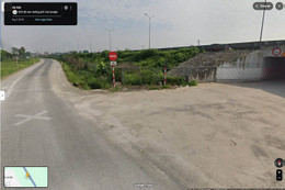
The second contributing factor involves the positioning and visibility of physical traffic signs. At the junction where motorists turn into the service road, the primary warning consists of a "No Entry" sign facing oncoming traffic rather than an advance directional sign explicitly prohibiting turns into the specific lane. Motorists approaching the intersection from perpendicular angles at night or during periods of reduced visibility find it exceptionally difficult to detect the restrictive signage, particularly while simultaneously monitoring cross-traffic and following auditory prompts from their mobile devices.
Legal Consequences and Regulatory Framework
The financial and administrative fallout for motorists caught in this trap is substantial. Under Vietnam’s current traffic regulations, specifically Decree 168/2024/NĐ-CP governing administrative penalties for road and railway transportation violations, driving a motor vehicle in the wrong direction on a one-way street or on a highway where traffic moves in the opposite direction carries a severe penalty.
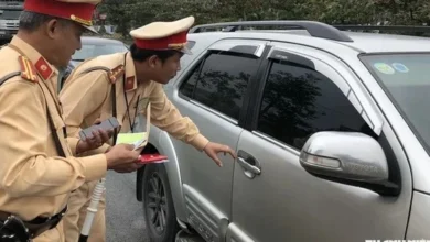
Mr. Huy was issued an official fine ranging between 18 million and 20 million Vietnamese đồng—specifically settling at 19 million đồng—pursuant to Point d, Clause 9, Article 6 of the decree. In addition to the heavy monetary fine, the infraction results in the mandatory deduction of points from the offender’s driving license, creating long-term administrative inconveniences for professional and private drivers alike.
Broader Implications for Smart Mobility and Infrastructure Management
The recurring incidents at the Phù Xuyên underpass underscore a broader systemic challenge within modern urban and highway management: the friction between legacy physical infrastructure and digital navigation ecosystems. As autonomous routing applications increasingly dictate driver behavior, municipal authorities and expressway operators face an urgent need to harmonize physical traffic management with digital platforms.
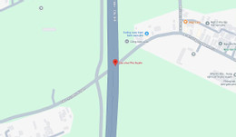
Traffic safety experts emphasize that reliance on digital maps should always be supplemented by vigilant observation of physical road signs. However, infrastructure planners also bear the responsibility of ensuring that road markings, lane dividers, and warning signs provide unambiguous guidance well in advance of complex intersections. The use of ambiguous dashed lines alongside restrictive signage creates cognitive dissonance for drivers, exacerbating the risk of accidental infractions.
Recommendations for Motorists and Authorities
To mitigate similar incidents in the future, affected drivers have proposed several actionable recommendations for local authorities. First, clear advance warning signs should be installed prior to intersections where service roads merge with or run parallel to high-speed corridors. Second, pavement markings should be strictly standardized to prevent confusion regarding traffic directionality. Finally, tech companies operating mapping services must establish more responsive channels to verify and update localized road statuses reported by motorists.
Until comprehensive adjustments are implemented, drivers unfamiliar with the Pháp Vân – Cầu Giẽ expressway and surrounding regional routes are advised to exercise heightened caution, prioritize physical signage over automated routing applications during complex maneuvers, and remain vigilant when transitioning from major highways to local service networks.