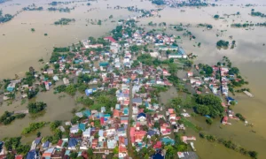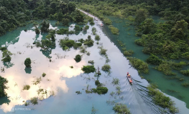
As heavy seasonal rains descend upon the mountainous terrain of Quang Binh province, the valley of Hung Trau within the Phong Nha-Ke Bang National Park has once again transformed into a vast, impassable reservoir. This annual meteorological phenomenon has severed the only concrete road connecting the outside world to the village of Yen Hop, the ancestral home of the Ruc people—one of the most isolated ethnic groups in Vietnam. The rising waters, which can reach depths exceeding two meters in certain sections, have effectively turned the community into a temporary island, highlighting the persistent logistical challenges faced by this unique population during the monsoon season.
The Geography of Isolation
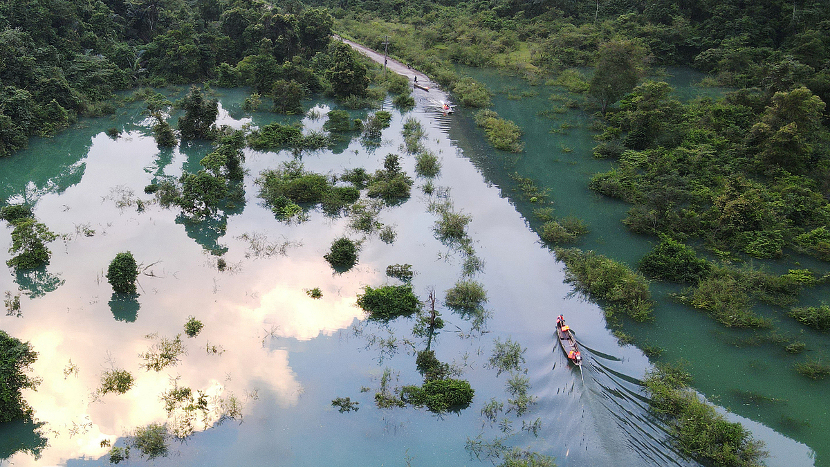
The village of Yen Hop, situated in Thuong Hoa commune, is characterized by its deep valley location and rugged limestone topography. The Hung Trau valley functions as a natural basin; due to its bowl-like geological structure and the absence of natural drainage outlets on the valley floor, it acts as a catchment area for heavy rainfall between September and November each year.
The road in question, a six-kilometer concrete route connecting the Ho Chi Minh Highway to the Ruc settlement, features a one-kilometer stretch that becomes completely submerged during peak rainfall. This isolation is not merely a temporary inconvenience but a recurring cycle that shapes the rhythm of life for the Ruc people. Historically, the Ruc resided in deep caves, relying on foraging, hunting, and primitive gathering. It was not until 1959 that border guards officially discovered the community and began efforts to integrate them into the modern administrative framework, moving them to higher ground to facilitate agriculture and permanent housing.
A Chronology of Vulnerability
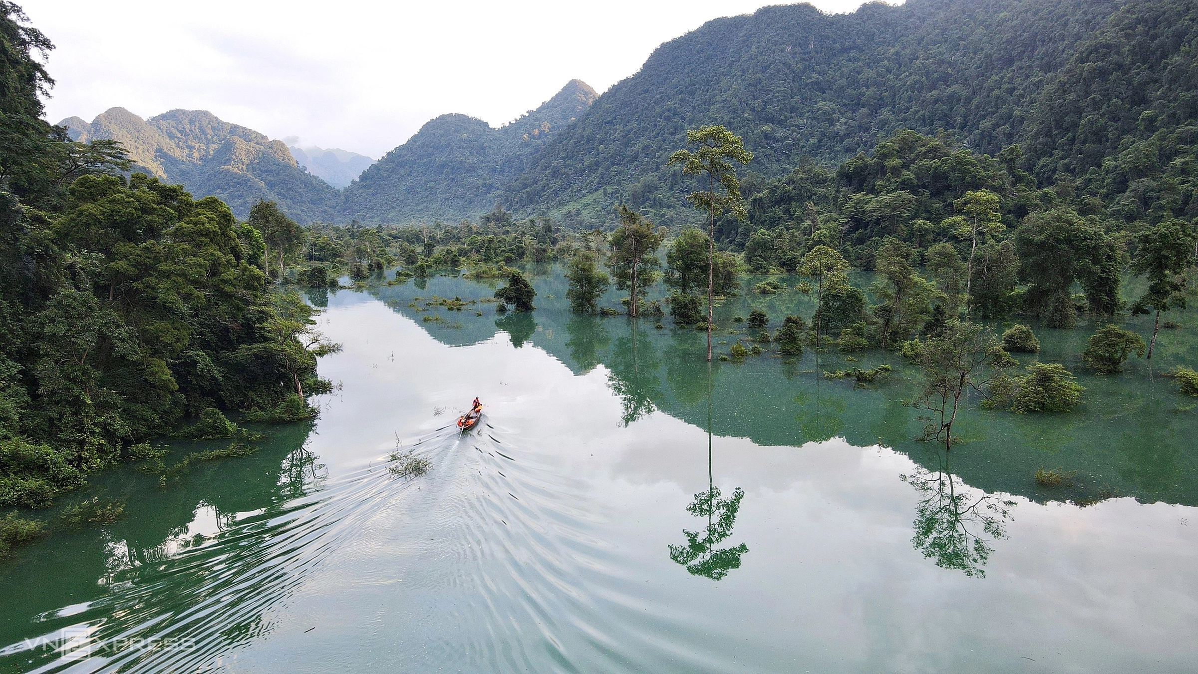
The current situation is a repeat of a well-documented seasonal struggle. According to local records, the floodwaters typically linger for seven to 30 days, depending on the severity of the precipitation. During this period, the physical connection to the district center is severed, leaving the village dependent on waterborne transport.
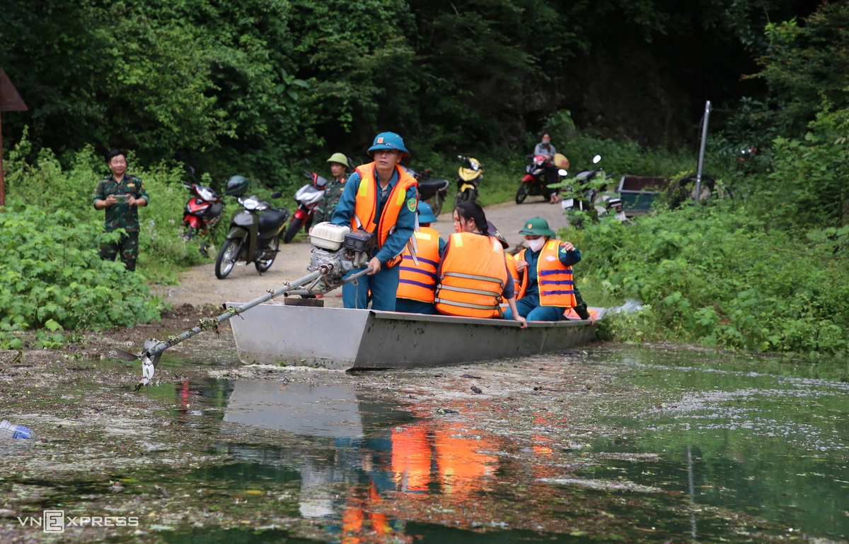
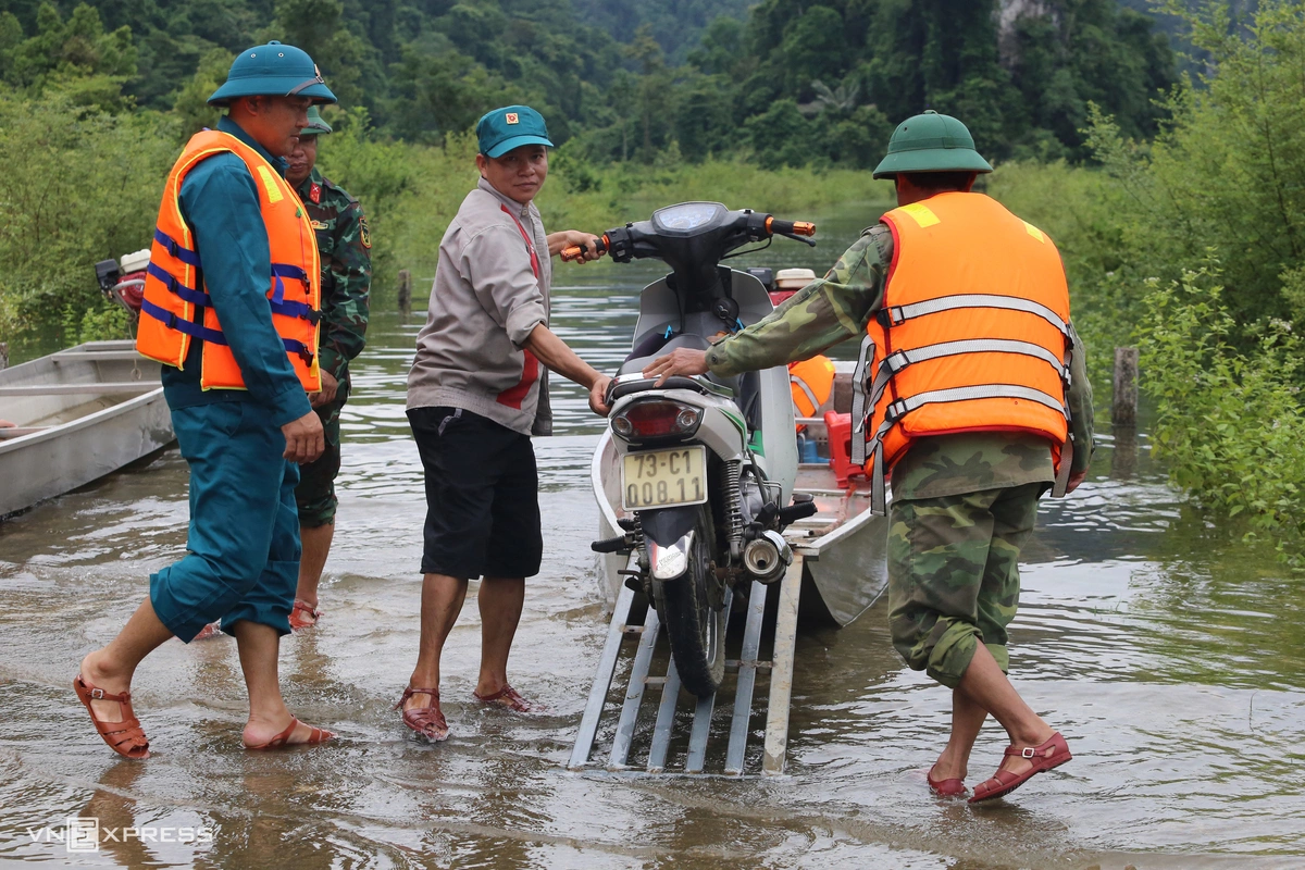
On September 18, 2026, as water levels surged, the local authorities in Thuong Hoa commune activated emergency protocols to ensure the safety and supply chain stability of the Ruc people. The People’s Committee of the commune has organized a free ferry service, managed by the local border guard station, to assist residents, students, and essential goods in crossing the submerged section of the road.
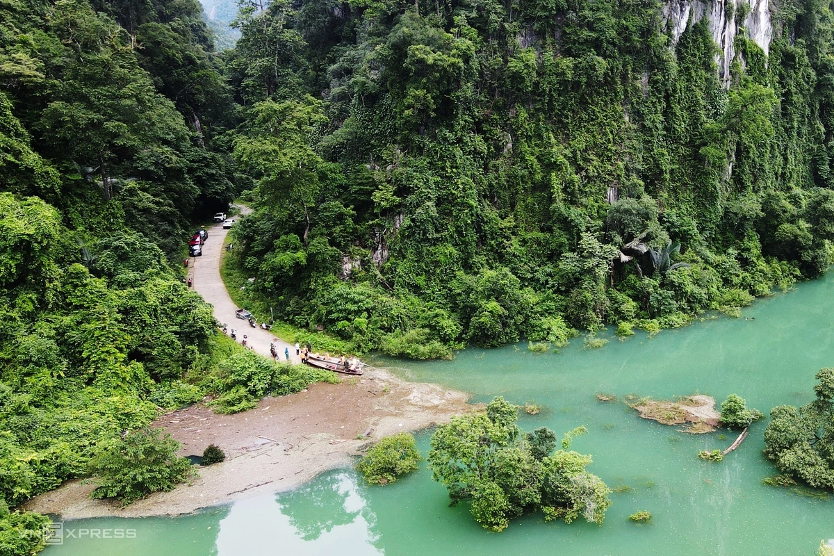
"We travel about four kilometers by motorbike from the village to the water’s edge, then transfer onto a boat to navigate through the Hung Trau section," explains Truong Van Anh, a resident of Yen Hop. "Once across, we travel another kilometer to reach the Ho Chi Minh Highway."
Sustaining the Ruc Community
The Ruc people, who belong to the Chut ethnic group, have shown remarkable resilience in the face of these annual disruptions. The community consists of approximately 800 people across more than 200 households. Despite the seasonal severance, they maintain a consistent level of agricultural production, primarily through rice cultivation and livestock farming, which provides them with a degree of self-sufficiency.
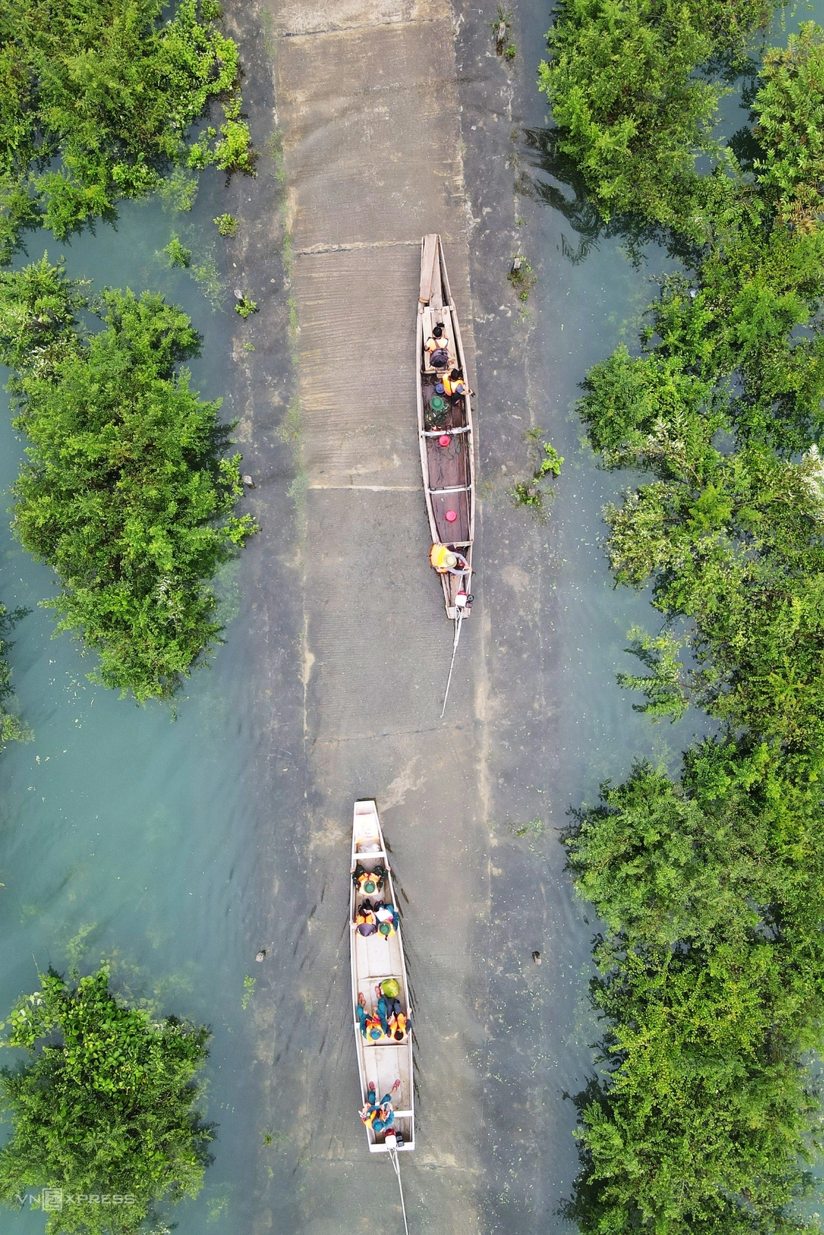
To mitigate the impact of the isolation, the local government initiates a proactive supply chain strategy before the peak of the rainy season. This includes the strategic transport of essential goods such as rice, cooking oil, salt, and medical supplies into the village. These stockpiles are critical for maintaining food security during the 7-to-30-day windows when the valley remains flooded. The border guards serve as the primary lifeline, operating on a 24-hour readiness schedule to respond to urgent health crises or transport needs that cannot wait for the waters to recede.
Economic and Social Implications
The recurring flooding of the Hung Trau valley serves as a stark reminder of the challenges inherent in providing infrastructure to remote ethnic enclaves. While the concrete road represents a significant improvement over the pre-1959 era, it remains susceptible to the unforgiving forces of nature.
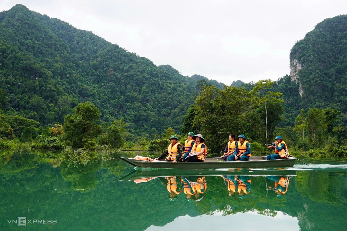
For the Ruc community, the flooding also brings an unexpected influx of attention. In recent years, the unique landscape of the flooded valley—with its emerald-green water reflecting the towering limestone cliffs—has attracted curious travelers and researchers. While this highlights the aesthetic value of the Phong Nha-Ke Bang region, it places an additional burden on the limited transport infrastructure, as local boats must now accommodate both residents and visitors. During periods of high traffic, private boat services emerge, charging approximately 20,000 VND per trip, though the government-provided ferry remains the primary, cost-free alternative for villagers.
Fact-Based Analysis of Future Challenges
The long-term sustainability of Yen Hop village remains a subject of ongoing discussion among regional planners. The fundamental issue is the "bowl" geography of the area, which makes total flood mitigation nearly impossible without massive engineering interventions that could potentially disturb the delicate ecology of the Phong Nha-Ke Bang National Park—a UNESCO World Heritage site.
Instead, the focus has shifted toward adaptive strategies:
- Infrastructure Hardening: Improving the structural integrity of the six-kilometer access road to ensure it can withstand the corrosive impact of stagnant floodwater.
- Enhanced Supply Logistics: Automating or formalizing the supply chain process to ensure that even during sudden, unpredicted flash floods, the village maintains a 14-day surplus of essentials.
- Emergency Medical Connectivity: Strengthening the presence of the border guard medical units, as the inability to reach provincial hospitals during the peak of the monsoon represents the most significant health risk to the population.
As climate change continues to alter weather patterns in Central Vietnam, the intensity and unpredictability of monsoon rains are likely to increase. The situation in Hung Trau is not an isolated event but a microcosm of the broader struggle to balance development, environmental preservation, and the well-being of ethnic minority populations in Vietnam’s most challenging terrains.
The resilience of the Ruc people, combined with the dedicated intervention of the local border guards, currently prevents these seasonal floods from becoming humanitarian crises. However, as the community continues to integrate into the broader socio-economic fabric of the country, the demand for more permanent, year-round access will undoubtedly grow, requiring innovative engineering solutions that respect the pristine natural beauty of the surrounding wilderness while securing the livelihoods of those who call the Hung Trau valley home.