Severe Tropical Weather System Triggers Torrential Rains, Flash Floods, and High Alerts Across Central and Southern Vietnam

A developing tropical depression situated just off the coast of Vietnam’s central provinces has intensified weather conditions significantly across the nation, driving torrential rainfall from the central regions down to the southern delta. While northern localities experience relatively stable conditions, the central and southern corridors are facing severe hydro-meteorological hazards, prompting emergency warnings from national forecasting agencies and local disaster management authorities.
The persistent weather pattern, which became a focal point for disaster response teams on September 13, has concentrated its heaviest impacts along the central coast. Meteorological data indicates that the proximity of the tropical depression has locked in moisture-laden air masses, creating sustained convergence bands that dump massive volumes of water over a compressed geographical footprint.
Meteorological Overview and Rainfall Distribution
According to the National Center for Hydro-Meteorological Forecasting (NCHMF), the active weather system has unleashed multi-day downpours characterized by high intensity and localized accumulation. The core of the heavy precipitation zone stretches dynamically from Ha Tinh province southward to the major urban and rural hubs of Quang Tri, Thua Thien Hue, Da Nang, and Quang Ngai.
Between the afternoon of September 12 and the morning of September 13, cumulative rainfall totals varied drastically by region, highlighting the severe nature of the coastal convergence. In Ha Tinh and the northern parts of Quang Tri, alongside the eastern sections of Quang Ngai, moderate to heavy rain prevailed with baseline measurements ranging from 50 to 100 millimeters. However, extreme convective cells pushed totals past the 180-millimeter mark in several localized sectors.
The situation proved even more critical further down the coast. From the southern expanse of Quang Tri through to the municipality of Da Nang, the NCHMF recorded torrential downpours with accumulations widely ranging from 100 to 200 millimeters. In isolated pockets within this corridor, precipitation breached the 350-millimeter threshold within a span of less than 24 hours. Concurrently, northern provinces such as Thanh Hoa and Nghe An experienced moderate to heavy spells averaging 20 to 40 millimeters, with localized peaks exceeding 100 millimeters, compounding runoff risks in upstream river basins.
Expanding Impact Across the Central Highlands and Southern Region
While the central coastline bears the brunt of the primary depression, secondary atmospheric instabilities have simultaneously triggered widespread heavy rainfall across the Central Highlands (Tay Nguyen) and the Southern Region, including economic centers like Ho Chi Minh City.
Starting late September 12 and continuing through September 13, eastern provinces stretching from Gia Lai down to Lam Dong, alongside the broader Central Highlands and southern flatlands, recorded consistent moderate rain and thunderstorms. Rainfall depths in these areas generally fluctuated between 20 and 40 millimeters, though isolated thunderstorm cells pushed totals past 80 millimeters.
Meteorologists warn that these southern and highland downpours carry inherent convective threats. The storms are frequently accompanied by localized whirlwinds, lightning strikes, severe hail, and intense wind gusts capable of downing trees, damaging light agricultural infrastructure, and causing sudden urban waterlogging during peak traffic hours.
Escalating Flood Risks and River Alarm Levels
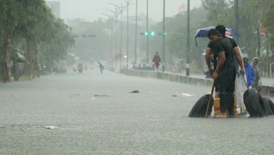
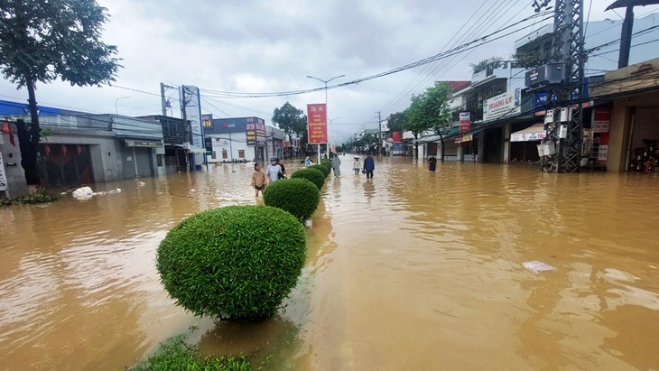
The unprecedented volume of water funneling through central watersheds has triggered urgent hydrological warnings. Competent authorities have issued high-level flood alerts for river networks originating in Thanh Hoa and extending southward to Da Nang.
Hydrological monitoring indicates that water levels on key rivers—particularly the Ngan Sau and Ngan Phu rivers in Ha Tinh province—are surging rapidly, expected to reach Alarm Level 2 to Alarm Level 3. Further north and south, upper catchments including the Bui, Ma, and Chu rivers in Thanh Hoa, the upper Ca River in Nghe An, and various river systems spanning from Quang Tri to Da Nang, are forecast to breach Alarm Level 1 and Alarm Level 2, with several stations trending above Alarm Level 2.
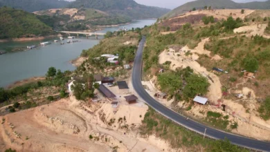
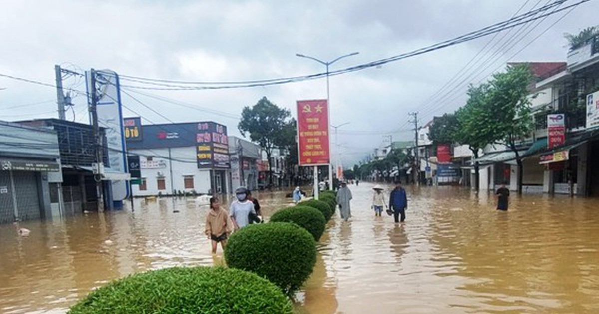
These rising water levels present an immediate threat of severe inundation in low-lying riparian zones, agricultural lowlands, and densely populated urban areas. Furthermore, prolonged antecedent rainfall has saturated mountain soils across the provinces from Thanh Hoa to Da Nang, creating an extreme risk of flash floods and devastating landslides along steep topography and hillside residential clusters.
Regional Weather Forecast Breakdown
As the tropical depression continues to influence national weather patterns, localized forecasts for September 13 reflect stark regional contrasts:
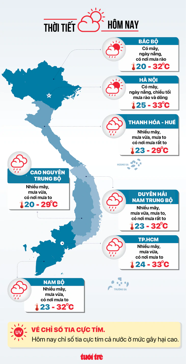
- Hanoi: Partly cloudy with sunny intervals during the daytime. Scattered rain showers and thunderstorms are expected by the afternoon and evening. Temperatures range from a low of 25–27°C to a high of 31–33°C.
- Northwest Vietnam: Generally clear to partly cloudy with persistent daytime sunshine. Nighttime and early morning conditions remain cool, with lows of 20–23°C and daytime highs reaching 29–32°C.
- Northeast Vietnam: Cloudier skies dominate the region, accompanied by intermittent scattered rain showers. Temperatures span from 22–26°C overnight to 30–33°C in the afternoon.
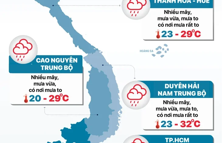
- Thanh Hoa to Thua Thien Hue: Heavily overcast skies with persistent moderate to torrential rain and embedded thunderstorms. Daytime temperatures are notably suppressed due to cloud cover, ranging from lows of 23–26°C to highs of 26–29°C.
- South-Central Coast (Duyen hai Nam Trung Bo): Overcast with widespread heavy to torrential downpours and severe thunderstorms in localized areas. Temperatures hover between 23–26°C at night and peak at 29–32°C during breaks in the rain.
- Central Highlands (Tay Nguyen): Cloudy with continuous moderate rainfall and locally heavy downpours. Minimum temperatures range from 20–23°C, while maximum daytime temperatures reach 26–29°C.
- Southern Vietnam: Mostly cloudy conditions with widespread moderate rain and scattered heavy thundershowers. Nighttime lows register at 23–26°C, with afternoon highs reaching 29–32°C.
- Ho Chi Minh City: Overcast skies with steady moderate rain and occasional heavy downpours accompanied by thunderstorms. Temperatures remain relatively stable, ranging from 24–26°C at night to 31–33°C during the day.
Emergency Response and Preparedness
In response to the escalating hydro-meteorological threat, provincial disaster prevention steering committees across the central region have activated emergency protocols. Local administrations have been instructed to continuously monitor rainfall and river gauges, issue timely evacuation warnings for communities residing in high-risk flash flood and landslide zones, and deploy rescue personnel to vulnerable coastal and riverine areas.
Maritime authorities have also issued advisories to vessels operating in the Gulf of Tonkin and central waters, warning of rough seas, reduced visibility, and strong wind gusts associated with the peripheral bands of the tropical depression. Residents in urban centers prone to deep flooding—such as Da Nang and major provincial capitals—are advised to limit non-essential travel and take proactive measures to secure property against rising water levels.