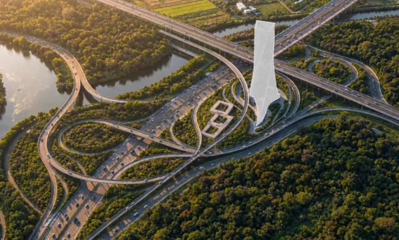
Ho Chi Minh City has officially unveiled an ambitious architectural and engineering design for a major multi-level interchange project intended to alleviate chronic congestion at the vital gateway connecting the Cat Lai Port to the broader regional transport network. This infrastructure endeavor, centered on the intersection of the Cat Lai–Phu Huu connector, is designed to link Ring Road 3 with the Ho Chi Minh City–Long Thanh–Dau Giay expressway, serving as a critical artery for the nation’s most active commercial port.

The Architectural Vision and Design Philosophy
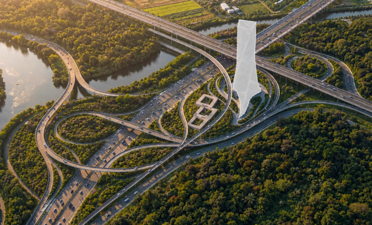
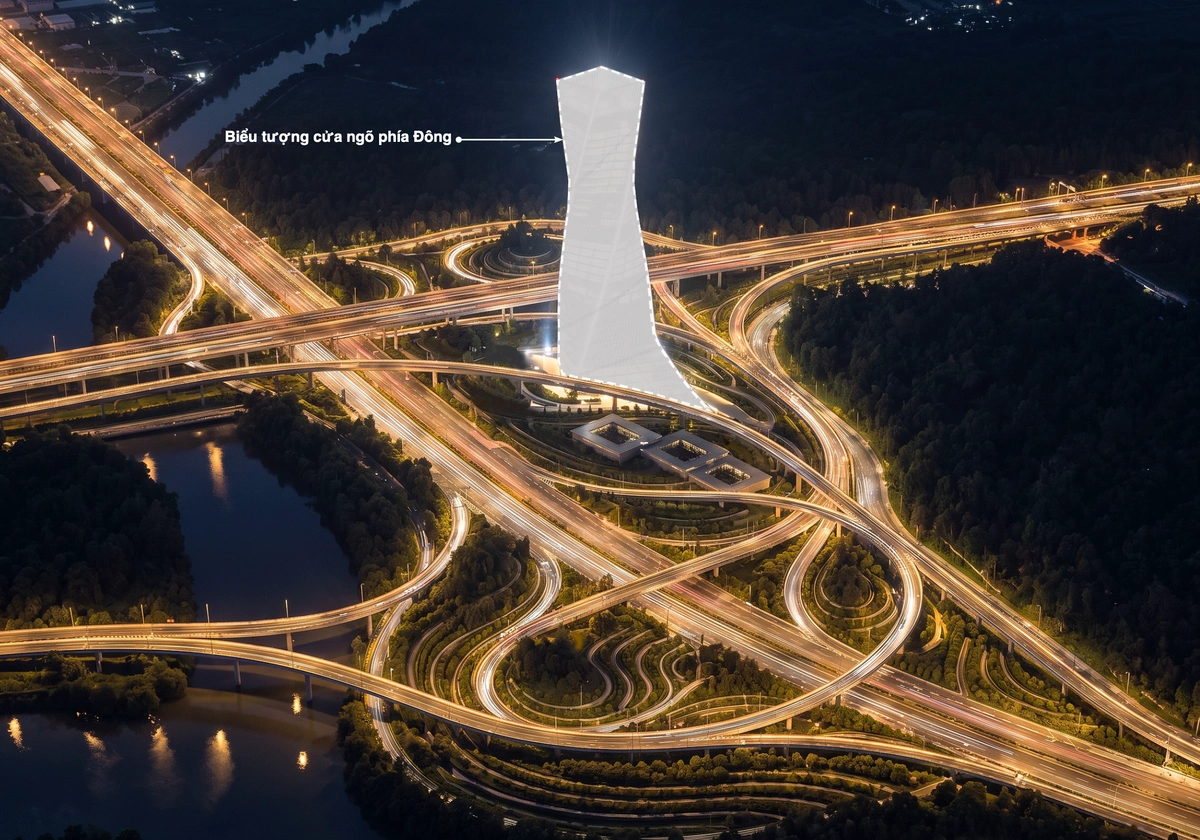
The approved design, spearheaded by the joint venture between B.R and HAS Architecture, departs from utilitarian infrastructure norms by integrating aesthetic "landmark" elements. The centerpiece of the proposal is a soaring, twisted-form tower situated amidst the complex layering of bridge structures. This vertical landmark, characterized by a tapered middle section and dynamic, rotating facades, is intended to serve as a visual gateway to the eastern entrance of the city.
Beyond its aesthetic appeal, the design prioritizes functional efficiency. The layout utilizes a complex series of elevated bridges and underpasses, effectively segregating heavy port-bound logistics traffic from local commuters. By creating a multi-level flow, the project aims to eliminate the intersection bottlenecks that have historically plagued the Cat Lai–Phu Huu route, which currently relies on surface-level traffic lights.
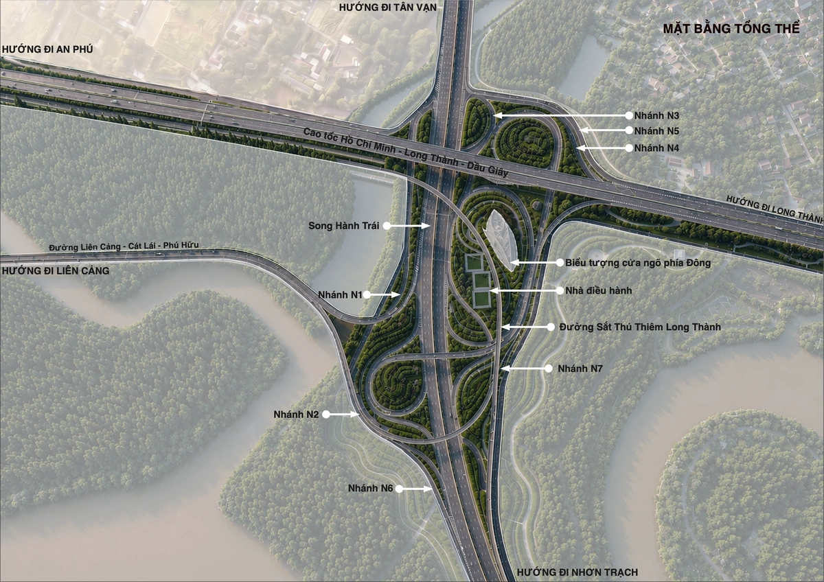
The design team has also emphasized environmental integration. Taking inspiration from the surrounding river network and lush delta landscape, the proposal includes significant green corridors, water features, and landscaped gardens nestled between the bridge branches. These elements are not merely decorative; they are engineered to provide noise buffers and natural cooling, mitigating the "concrete jungle" effect often associated with massive urban interchanges.
Chronology and Project Scope
The project, which carries a total investment of approximately 8,782 billion VND sourced from the municipal budget, is a cornerstone of Ho Chi Minh City’s master plan for port logistics. The construction covers a route stretching nearly six kilometers with a standard width of 60 meters.
- Pre-2026: Initial assessments of the Cat Lai port bottleneck were conducted, identifying the intersection of Nguyen Thi Dinh street and the port gate as a primary failure point in the city’s logistics chain.
- Late 2026: The municipal government officially approved the architectural and engineering plans for the multi-level interchange.
- 2027–2028: The projected timeline for the primary construction phase, with the goal of establishing seamless connectivity between the port complex and the regional expressway network.
The current phase of the Cat Lai route, beginning at Nguyen Thi Dinh Street near the Truong Van Bang intersection, is currently limited by its reliance on surface-level traffic management. While the current 6-lane configuration is already undergoing study for potential widening, the new interchange project represents a structural shift toward a grade-separated system that will handle the high-volume traffic influx more effectively.
Economic and Logistical Implications
The Cat Lai Port is the largest and busiest container port in Vietnam, handling a significant percentage of the country’s import and export volume. Consequently, the congestion surrounding this facility is not merely a local transit issue; it is a significant national economic concern. Logistics experts estimate that delays at the port gate contribute to substantial increases in operational costs for shipping companies, which are ultimately passed down to consumers.
The implementation of the new interchange is expected to have several measurable impacts:
- Reduction in "Dead Time": By removing traffic light stops for port-bound trucks, the average transit time for container transport is expected to drop by 20% to 30%.
- Increased Port Throughput: A more efficient exit and entry system allows for a higher volume of containers to be processed per hour, maximizing the utility of the port’s existing berth capacity.
- Improved Traffic Safety: The segregation of heavy goods vehicles from local passenger traffic—achieved through elevated lanes and dedicated frontage roads—is designed to drastically reduce the frequency of accidents in the area.
Supporting Data and Technical Specifications
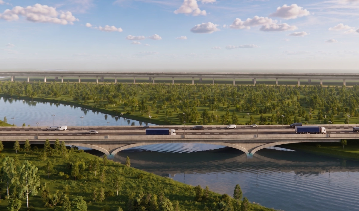
The design includes several technical features aimed at long-term sustainability. The elevated bridge segments are constructed with a focus on structural load-bearing efficiency, utilizing high-performance concrete to ensure longevity in the humid, saline environment of the coastal region.
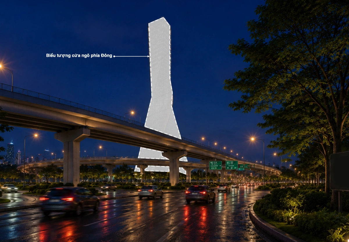
The illumination strategy is another key component. Slender, modern light poles with warm-toned LED arrays are integrated with dark-colored metallic railings. This not only enhances night-time visibility but also highlights the architectural curves of the structure, transforming the interchange into a signature urban feature after sunset.
Furthermore, the "song hanh" (parallel) roads located beneath the elevated structures are designed to serve the local population. These roads ensure that the connectivity of the surrounding residential and commercial zones is not severed by the massive infrastructure, allowing local traffic to flow independently of the high-speed transit lanes.

Official Stance and Stakeholder Reactions
While the project is still in the pre-construction phase, the municipal administration has underscored its importance as a "strategic investment" in the city’s future competitiveness. Representatives from the Department of Transport have noted that the integration of the interchange with the Ring Road 3 project is essential for the cohesive development of the southern key economic zone.
The choice of a design-heavy approach has been met with positive, albeit cautious, feedback from urban planners. While some experts emphasize that the priority must remain on durability and maintenance costs, others argue that investing in "landmark" infrastructure helps to redefine the urban identity of the eastern districts, which are rapidly transitioning from industrial zones into modern urban hubs.
The Broader Impact on HCMC’s Development
As Ho Chi Minh City continues to expand its footprint, the pressure on its infrastructure is mounting. The eastern region, encompassing districts that are home to both massive port facilities and high-density residential developments, remains the most critical zone for infrastructure investment.
The success of the Cat Lai interchange project will likely set a precedent for future infrastructure tenders in Vietnam. The shift toward incorporating landscape architecture and aesthetic considerations into "heavy" civil engineering projects reflects a maturing approach to city building. It acknowledges that transit hubs are not merely functional tools for moving vehicles, but are defining elements of the urban fabric that impact the quality of life, the environment, and the international perception of the city.
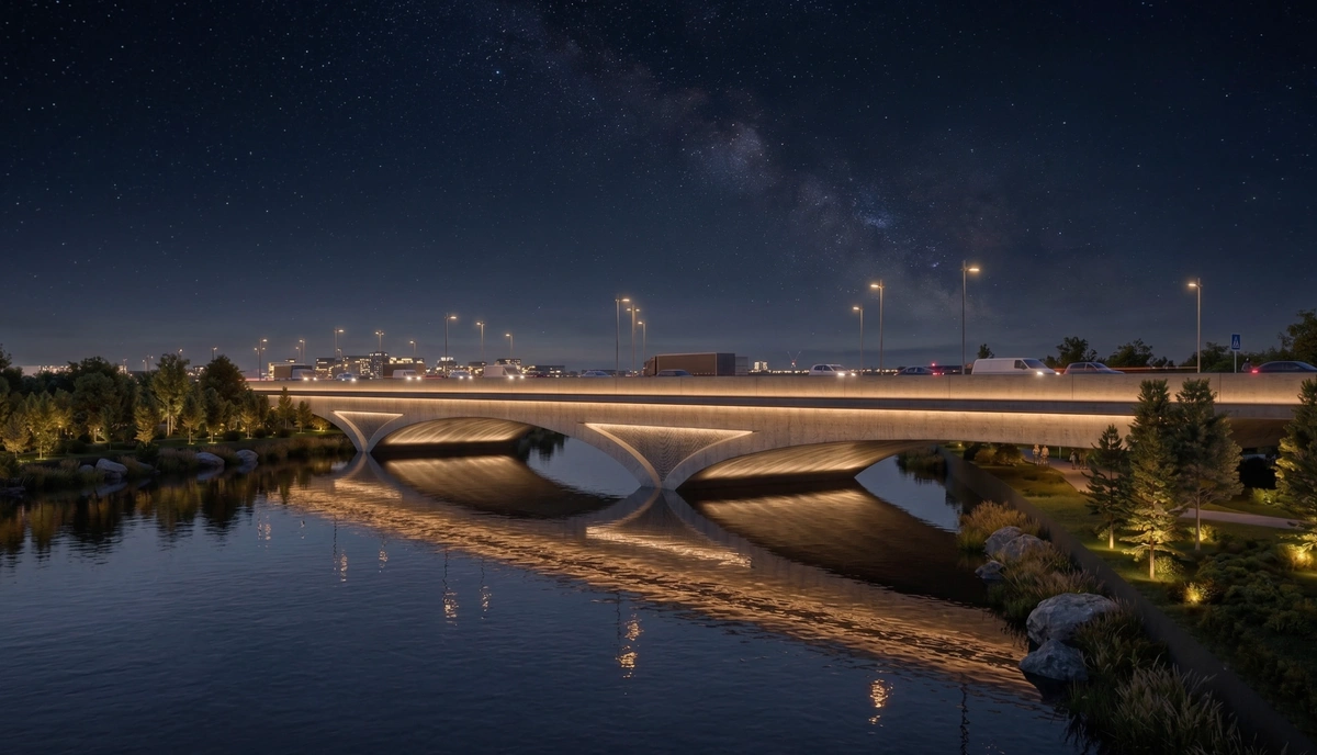
As the 2028 completion deadline approaches, the project will be closely watched by domestic and international investors alike. If it successfully alleviates the congestion at the gateway to the nation’s busiest port, it will serve as a definitive model for how major metropolitan areas can balance the demands of industrial logistics with the needs of a growing, modern city. The project represents a significant step toward transforming Ho Chi Minh City into a more efficient, interconnected, and aesthetically conscious global commercial center.
Related posts: