The increasing reliance on digital navigation tools in unfamiliar geographical terrains was starkly highlighted in the early hours of September 9, when a routine spiritual journey turned into a harrowing ordeal for three young men. Traveling through the picturesque yet challenging topography of Himachal Pradesh, the group narrowly escaped a catastrophic accident after their vehicle veered off a cliffside road. The incident, which occurred around 0:30 AM near the town of Chintpurni in the Una district, underscores the latent dangers of blind compliance with mapping applications, particularly during nighttime driving in rugged, mountainous regions.
Background Context and Journey Origins
The sequence of events began earlier in the evening when three friends from Jind, a district in the neighboring state of Haryana, set out on a late-night road trip. Their intended destination was the revered Baglamukhi Temple, a prominent spiritual site known for drawing pilgrims from across northern India. Road trips involving overnight driving are a common practice among devotees seeking to maximize their time at holy sites, avoiding daytime traffic congestion on national and state highways.
However, undertaking such journeys in unfamiliar terrain during the dead of night introduces significant operational hazards. Mountainous regions like Himachal Pradesh feature complex road networks characterized by steep gradients, unpaved shoulders, narrow tracks, and frequent hairpin bends. In the absence of daylight, depth perception is severely compromised, and the lack of comprehensive street lighting along secondary and tertiary routes places an extraordinary burden on drivers to remain vigilant.
Chronology of the Incident
As the trio approached the vicinity of Mubarikpur during the midnight hours, fatigue began to set in. Recognizing the need for rest before continuing their pilgrimage at dawn, the driver pulled over briefly to search for a local homestay or accommodation using a smartphone. Relying on Google Maps to navigate the immediate area and locate a place to stay, the driver resumed the journey based on the digital prompts provided by the application.
At around 0:30 AM, while navigating through the Rehi area, the navigation software rerouted the vehicle away from the primary highway. Instead of continuing along the main arterial route, the car was directed down the narrow, descending path of the Gugga Mandir road leading toward Duhal Bangwala.
Unbeknownst to the driver, this route is classified as a narrow, unpaved mountain track flanked by steep drop-offs rather than a standard vehicular thoroughfare. Shrouded in complete darkness, the driver continued to follow the digital directions. Within minutes, the automobile lost traction, slipped off the edge of the unpaved track, and plunged over the shoulder of the road, tumbling toward the precipitous valley below.
The Rescue Operation and Immediate Aftermath
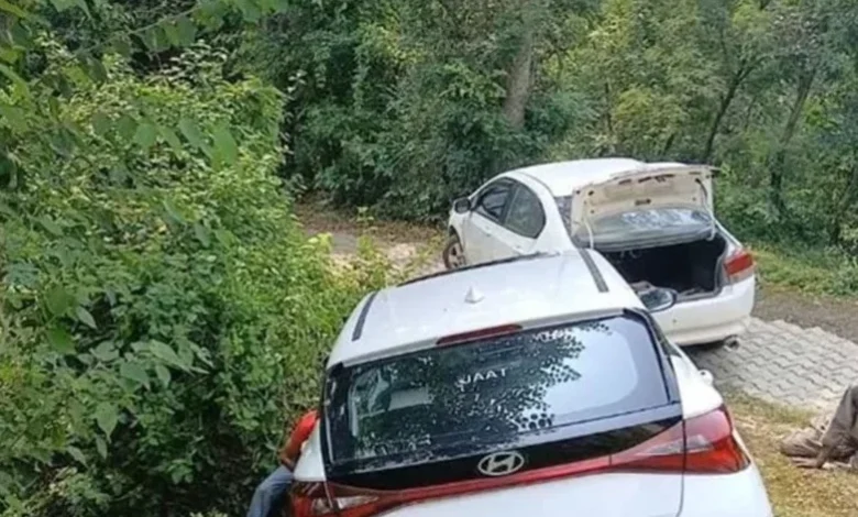
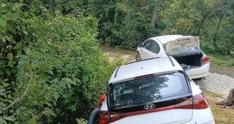
Catastrophe was averted only by a fortunate geographic anomaly: the vehicle snagged in a dense thicket of roadside brush and trees just beyond the precipice. Local rescue officials later noted that had the car continued its descent for even a few more meters, it would have dropped entirely down the sheer cliff face, resulting in severe injuries or fatalities. Miraculously, all three occupants remained inside the vehicle and escaped physical harm, though they were left shaken by the sudden drop.
Local residents, alerted by the unusual sounds of the vehicle leaving the road and the subsequent commotion, quickly mobilized to assist the stranded travelers. Upon discovering the precarious position of the car, villagers immediately notified the Chintpurni police station.
Station House Officer Rajesh Kumar, alongside a detachment of local law enforcement officers, arrived promptly at the scene to assess the situation and ensure the safety of the tourists. Recognizing the trauma and exhaustion of the young men, the police assisted in arranging temporary overnight shelter for the group.
By sunrise, local residents and authorities mounted a coordinated recovery operation. Heavy-duty ropes were secured to the trapped automobile, and a secondary vehicle was utilized to winch the car back up to the surface level of the road. Despite sustaining minor structural damage, the vehicle was successfully retrieved.
Technological Implications and Regional Hazards
While local media reports and subsequent discussions heavily scrutinized the role of Google Maps in the incident, technical breakdowns of such events often point to a confluence of user error, algorithmic limitations, and environmental factors. Digital mapping applications are designed to calculate the shortest or fastest route between two points based on available geographic data. In rural or mountainous areas, algorithms may classify pedestrian paths, old logging trails, or narrow agricultural tracks as valid vehicular routes if those paths exist within regional spatial databases.
When motorists utilize these applications at night, the visual cues that would normally signal a transition from a major highway to a hazardous track—such as deteriorating road surfaces, lack of signage, or sharply narrowing widths—are frequently obscured by darkness. Consequently, drivers tend to maintain a higher level of trust in the digital interface than in their immediate physical surroundings.
Transportation safety advocates emphasize that navigation software should be treated strictly as an advisory tool rather than an infallible authority. In regions like Himachal Pradesh, Jammu and Kashmir, and Uttarakhand, where rapid elevation changes and rugged geography create treacherous driving conditions, adherence to physical road signs, local milestones, and direct inquiries with residents remains vital for motorists.
Broader Impact and Expert Recommendations
The Chintpurni incident has reignited discussions among regional authorities and transport safety experts regarding the need for enhanced digital mapping accuracy and greater driver awareness. Local governments have repeatedly urged tech companies to update regional geographic information systems to better distinguish between primary highways and narrow mountain tracks unsuitable for standard passenger vehicles.
For motorists planning road trips through unfamiliar terrains, safety experts offer several key recommendations:
- Verify Routes in Advance: Plan journeys during daylight hours whenever possible, and study the primary route using physical maps or verified regional guides before relying entirely on dynamic GPS routing.
- Exercise Caution with Shortcuts: If a navigation app suddenly redirects a vehicle from a major paved highway onto a narrow, unlit, or unpaved secondary road, the driver should evaluate the physical conditions rather than blindly following the prompt.
- Cross-Reference with Signage: Always prioritize physical traffic signs, local warnings, and official directional markers over digital instructions.
- Pull Over Safely for Troubleshooting: When searching for accommodations or rerouting during nighttime hours, drivers should stop in well-lit, populated areas such as town centers or established fuel stations rather than attempting to navigate complex deviations on the fly.
As the tourism sector continues to grow in India’s northern mountainous states, incidents of vehicles straying onto dangerous paths due to GPS misdirection serve as cautionary tales for travelers. While the three pilgrims from Haryana returned home safely, their experience stands as a stark reminder of the delicate balance between modern technological convenience and the raw, unforgiving realities of mountainous terrain.