Hanoi Unveils Ambitious Landscape Corridor Project to Transform Red River Waterfront by 2038

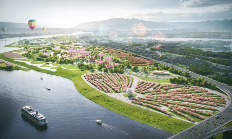
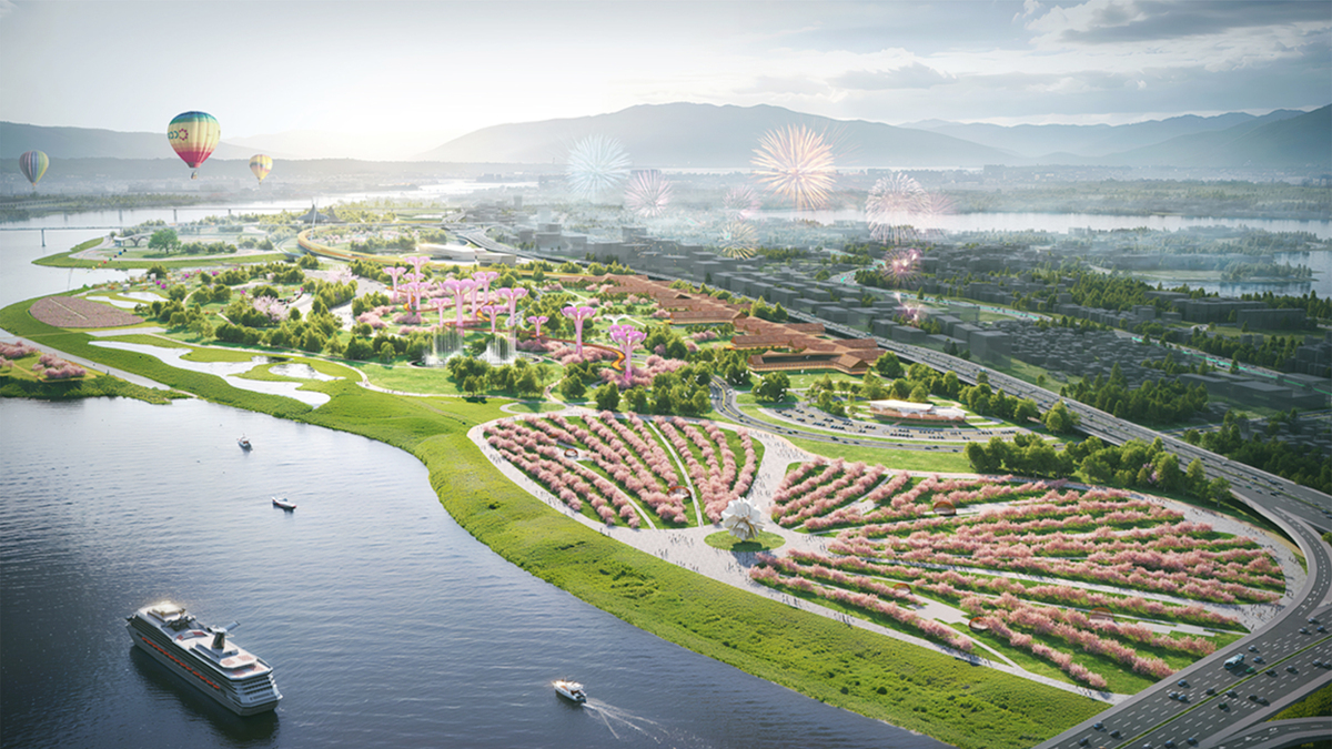
Hanoi is embarking on a monumental urban transformation project aimed at redefining the capital’s relationship with the Red River. As of September 15, 2026, the Hanoi People’s Committee has officially opened a 20-day public consultation period regarding the comprehensive adjustment of the 1/5,000 scale zoning plan for the Red River urban area. This initiative represents a strategic shift in the city’s spatial development, prioritizing ecological sustainability, cultural preservation, and the creation of a massive, interconnected network of urban parks.
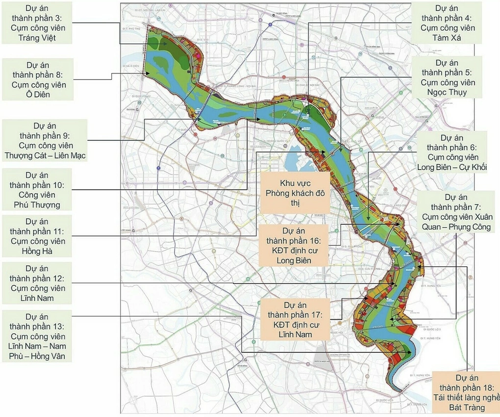
The core of this vision is the "Red River Landscape Corridor," a 40-kilometer stretch spanning from Hong Ha Bridge to Me So Bridge. By integrating 11 major park clusters and a multi-tiered land-use strategy, the city intends to turn the riverbanks—previously underutilized or fragmented—into the central "urban living room" of the capital.
A Chronology of Strategic Urban Development
The plan is not a singular event but a phased, long-term development strategy. The project timeline is structured into two primary phases, with preparatory work already underway:
- 2026–2030 (Initial Implementation): This phase focuses on foundational infrastructure. The city will prioritize the development of the Phu Thuong and Hong Ha riverbank parks. Simultaneously, authorities will initiate the dredging and leveling of the riverbed, the fortification of riverbanks, and the development of specific urban residential areas in the districts of Linh Nam and Long Bien. This period also includes essential land clearance and the beginning of the "landscape axis" construction.
- 2030–2038 (Completion): The final phase involves the completion of the remaining sub-projects, ensuring that the entire 40-kilometer corridor is fully integrated into the metropolitan infrastructure. This period focuses on finalizing the secondary park systems and the full activation of the multi-modal transport network.
Architectural Philosophy and Multi-Tiered Zoning
The Red River master plan utilizes a sophisticated "adaptive urbanism" model, recognizing the river’s dynamic nature and the necessity of flood mitigation. A key technical feature of the project is the strict regulation of building heights based on flood levels and land vulnerability.
According to the Hanoi Institute of Construction Planning, the height restrictions are divided into four specific tiers to ensure both public safety and urban utility:
- Above 11.5 meters: Reserved for standard urban construction projects.
- 9.5m to 11.5m: Designated for "adaptive" structures capable of withstanding seasonal flooding. This includes floating houses and stilt-based recreational facilities, designed to serve as communal spaces during the dry season.
- 7.5m to 9.5m: Prioritized for pedestrian walkways and semi-submerged riverbank parks.
- Below 7.5 meters: Exclusively for walking paths and flood-tolerant nature parks.
This zoning strategy ensures that 25% of each sector is dedicated to specialized parks, with an additional 5% allocated for public, community-accessible green space. The objective is to maintain a natural aesthetic while providing essential "safety valves" for the city’s drainage system.
The 11 Park Clusters: A Green Spine
The master plan identifies 11 critical park clusters that will serve as the anchors for the landscape corridor. These include the Trang Viet, Tu Dien, Thuong Cat–Lien Mac, Phu Thuong, Hong Ha, Linh Nam, Linh Nam–Nam Phu–Hong Van, Tam Xa, Ngoc Thuy, Long Bien–Cu Khoi, and Xuan Quan–Phung Cong parks.
These clusters are designed to function as "green lungs" for Hanoi. They are not merely ornamental; they are engineered to act as natural water retention zones, helping to mitigate the urban heat island effect and providing a buffer against climate-related environmental risks. The connectivity between these parks and the wider city is a cornerstone of the plan, with an east-west "green axis" designed to integrate the riverine environment with the densely populated urban core.
Infrastructure and Economic Integration
Beyond greenery, the project aims to overhaul Hanoi’s connectivity. The plan includes the construction of 17 new bridges crossing the Red River, which will significantly improve the flow of traffic between the city’s central districts and its growing eastern suburbs.
The economic strategy is equally ambitious. Hanoi authorities are planning to transition existing cargo-handling ports—which have historically dominated the riverfront—into modern tourism-oriented ports. By "re-orienting" the river toward leisure and commerce, the city hopes to boost tourism revenue and improve the quality of life for its residents. The modification of shipping routes and the development of urban rail connections are intended to support this shift, making the riverfront a vibrant destination rather than a logistical periphery.
Expert Analysis and Official Perspectives
Urban planners view this project as a necessary evolution for a capital city that has historically struggled to integrate its primary waterway into its urban identity. By formalizing the 1/5,000 scale zoning, the Hanoi People’s Committee is providing a legal framework that prevents chaotic development and ensures that the Red River area remains a public asset.
"The goal is to create a harmonious blend of nature and city," an official from the Hanoi Institute of Construction Planning noted during the proposal phase. The emphasis on "flexible" architecture shows a maturing understanding of climate change risks. Rather than attempting to block the river’s natural behavior through massive concrete walls, the city is opting for an "adaptive" approach that accepts the river’s fluctuating levels.
However, the scale of the project remains a significant challenge. The successful implementation will require massive coordination across multiple municipal departments, significant capital investment, and the sensitive handling of land clearance. The 20-day public consultation period is a critical step in ensuring that the voices of local residents, particularly those in the affected riverbank districts, are incorporated into the final execution.
Broader Implications for Hanoi
If successfully realized, the Red River project will fundamentally alter the metropolitan landscape of Vietnam’s capital. It moves the city away from a model of rapid, unplanned growth toward a more sustainable, high-quality urban environment.
The project reflects a broader trend in Southeast Asian urban development, where cities are increasingly reclaiming their waterfronts to combat the environmental pressures of rapid urbanization. By setting aside such a large percentage of the waterfront for public use, Hanoi is signaling a commitment to social equity—ensuring that the most valuable land in the city is not just for the wealthy, but is a shared space for all citizens.
As the city enters the public consultation phase, the eyes of urban planners and the public alike will be on how these ambitious designs translate into tangible, daily experiences for the people of Hanoi. The 12-year window for completion (2026–2038) is an acknowledgement of the project’s complexity, yet the vision remains clear: a cleaner, greener, and more connected Hanoi, anchored by the lifeblood of the city—the Red River.