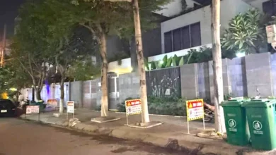
Heavy rainfall in Dong Nai leaves Tan Phong underpass and city center streets submerged


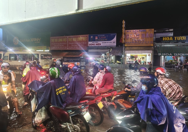
The city of Bien Hoa, the administrative heart of Dong Nai Province, experienced significant urban flooding on the afternoon of September 18, 2026, following a period of intense and sustained rainfall. The deluge, which began during the peak evening commute, overwhelmed local drainage systems, causing widespread traffic congestion and infrastructure disruptions across several key arterial roads. Among the most affected areas was the Tan Phong underpass, a critical piece of transport infrastructure that has historically struggled with water management during the monsoon season.
Chronology of the September 18 Inundation
The rainfall intensified rapidly starting at approximately 4:00 PM, coinciding with the hour when thousands of workers and students were returning home. By 6:00 PM, several low-lying zones in Bien Hoa were already reporting significant water accumulation.
Specific reports indicated that the area near the K8 military base on Bui Van Hoa Street was severely compromised, with water levels rising rapidly enough to impede the flow of traffic. Similarly, the vicinity around Alley 68 on Dong Khoi Street, located in the Trang Dai ward, became a focal point of the flooding. Motorists attempting to traverse these sections found themselves stranded as water seeped into vehicle engines, forcing many to abandon their motorcycles or wait for the water to recede. The resulting traffic gridlock extended for several kilometers, creating a bottleneck that paralyzed movement across the city’s central districts for hours.

The Tan Phong Underpass: A Recurring Vulnerability
The Tan Phong underpass, which serves as a vital junction between Dong Khoi Street and Nguyen Ai Quoc Street, once again proved to be a major vulnerability in the local road network. While the flooding reported on September 18 was described as "moderate" compared to previous catastrophic events, the accumulation of water was sufficient to cause concern among commuters.
The underpass, which stretches 430 meters—including a 50-meter enclosed section and 380 meters of open-cut design—has been a subject of scrutiny since its inauguration in 2018. Designed with the primary objective of alleviating the chronic congestion that previously plagued the Tan Phong roundabout, the structure was built to accommodate four lanes of traffic with a design speed of 60 km/h. However, despite these engineering specifications, the facility’s drainage capacity has consistently failed to keep pace with the region’s increasing intensity of rainfall.
Historical data suggests that this is not an isolated incident. In July 2023, the underpass suffered from extreme flooding, with water levels in the deepest sections exceeding 0.5 meters. During that event, multiple passenger vehicles suffered engine failure after drivers attempted to navigate the submerged passage, requiring emergency towing and rescue operations. On that occasion, local authorities were forced to close the underpass for several hours to facilitate large-scale pumping operations to evacuate the water.
Infrastructure and Urban Planning Challenges
The recurring nature of the flooding in Bien Hoa highlights a broader challenge in urban planning within the Dong Nai region. As the city has urbanized rapidly over the past decade, the proliferation of asphalt and concrete surfaces has reduced the ground’s natural ability to absorb rainwater. When this lack of permeability is combined with aging or undersized drainage systems, the result is a rapid accumulation of runoff during tropical downpours.

Civil engineering experts have previously noted that the Tan Phong underpass sits in a topographical basin, making it naturally prone to water collection. While the city’s Public Works Department has implemented various mitigation strategies—including the installation of high-capacity submersible pumps and the periodic clearing of debris from drainage grates—these measures often prove insufficient during the peak of the rainy season. The fundamental issue remains the capacity of the primary drainage trunk lines, which were designed for historical rainfall averages that no longer align with current weather patterns.
The Economic and Social Impact
The disruption caused by localized flooding has a tangible impact on the economic productivity of Bien Hoa. As an industrial hub of Vietnam, the city relies on the seamless movement of its workforce. During events like the one on September 18, the immobilization of the Tan Phong underpass acts as a force multiplier for traffic delays across the city.
Beyond the immediate inconvenience to commuters, the repeated flooding imposes a significant financial burden on the public sector. The costs associated with emergency response, traffic management, and road repairs following water damage are substantial. Furthermore, for individual citizens, the repair of flood-damaged vehicles represents a recurring and often uncompensated financial loss.
Official Responses and Future Mitigation Strategies
Following the events of September 18, local authorities have remained under pressure to provide a long-term solution. In previous public briefings, the Dong Nai Department of Transport has acknowledged the limitations of the existing drainage infrastructure at the Tan Phong underpass.
While the department has not released a new master plan in the immediate aftermath of this week’s rain, past policy statements have pointed toward a multi-pronged approach to address the issue. These strategies include:
- Capacity Expansion: Upgrading the pumping stations within the underpass to increase the liters-per-second discharge rate.
- Upstream Retention: Constructing additional detention basins in higher-elevation areas to capture runoff before it reaches the underpass.
- Smart Monitoring: Implementing real-time sensor technology that provides early warnings to the traffic police, allowing for the proactive closure of the underpass before water reaches critical depths.
Residents and local advocacy groups continue to call for a more robust investigation into the original design specifications of the underpass. There is a growing consensus that, regardless of the cause—be it climate change, inadequate drainage capacity, or faulty initial design—the status quo is unsustainable.
Broader Implications for Urban Resilience
The situation in Bien Hoa is indicative of a nationwide trend where infrastructure development is struggling to keep pace with extreme weather events. The "Tan Phong scenario" serves as a case study for city planners across Vietnam: the necessity of integrating climate-resilience measures into the design phase of all major infrastructure projects.
As the monsoon season progresses, the susceptibility of the Tan Phong underpass will remain a key metric for evaluating the city’s preparedness. For now, the residents of Bien Hoa are left to navigate the consequences of a design that, while intended to solve traffic, has created a new set of hydrologic challenges that the city is still learning to master. The events of September 18, 2026, serve as a stark reminder that in the face of intensifying environmental pressures, the maintenance and adaptation of existing infrastructure are just as critical as the construction of new projects.