Hanoi Unveils Ambitious Blueprint for Red River Landscape Corridor and Urban Redevelopment

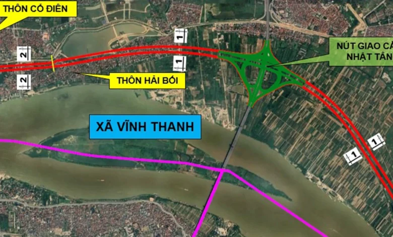
The Hanoi People’s Committee has officially unveiled a comprehensive planning proposal for the Red River landscape and urban corridor, marking a significant milestone in the capital’s long-term infrastructure and environmental development strategy. The plan, which outlines a detailed 1/500 scale master plan for the river’s scenic corridor, serves as a vital amendment to the broader 1/5,000 scale zoning plan for the Red River urban area. This initiative, currently under public consultation from September 7 to September 27, 2026, aims to transform the riverfront into a functional, aesthetic, and sustainable backbone for the city.

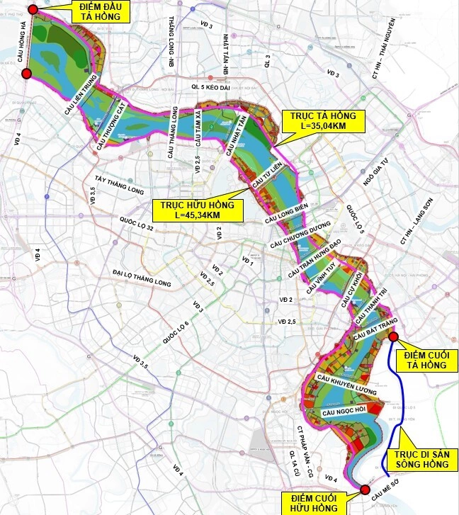
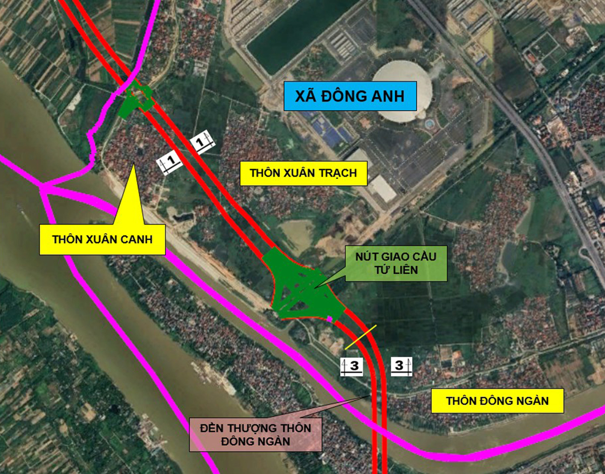
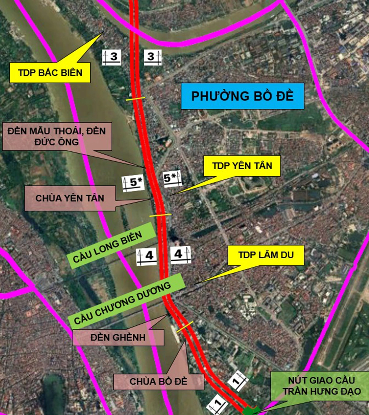
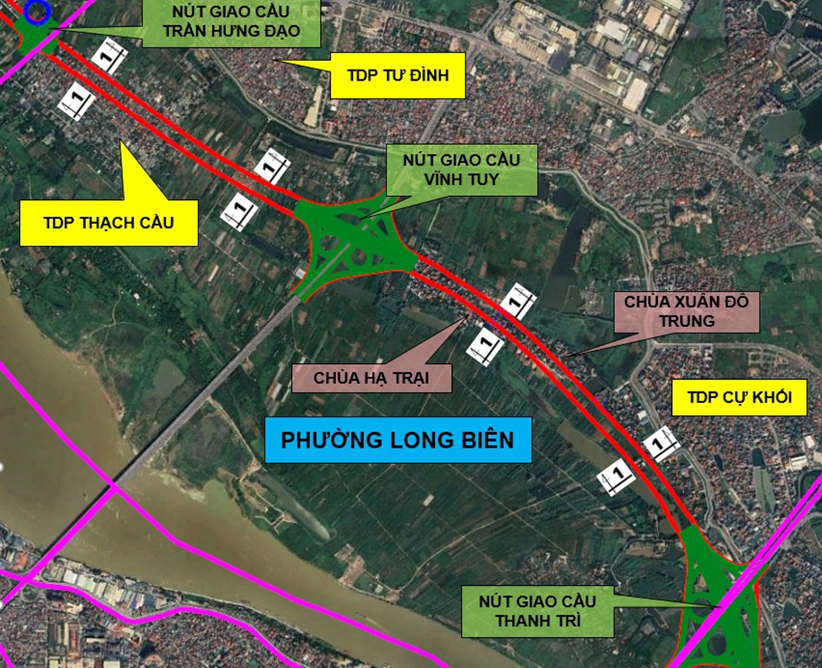
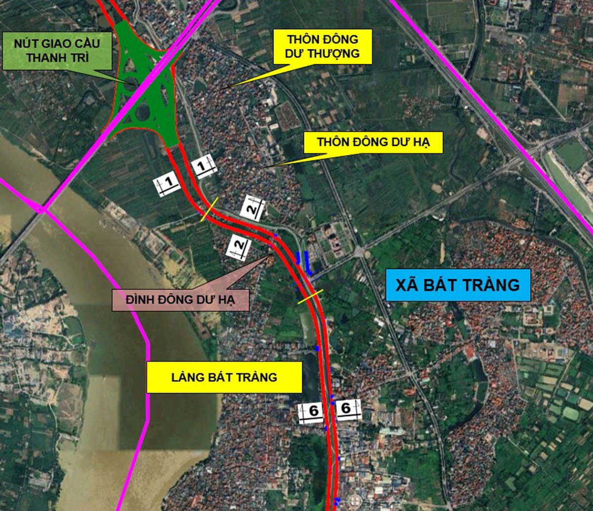
The proposed project focuses on the development of two major transport and landscape arteries running parallel to the Red River: the Ta Hong (Left Bank) and Huu Hong (Right Bank) routes. These corridors are designed to integrate flood defense systems with modern urban infrastructure, covering a total affected area of approximately 713 hectares. By balancing the necessity for robust flood management with the demands of urban expansion, the municipal government seeks to redefine the relationship between Hanoi’s historical center and its primary waterway.
Technical Scope and Alignment
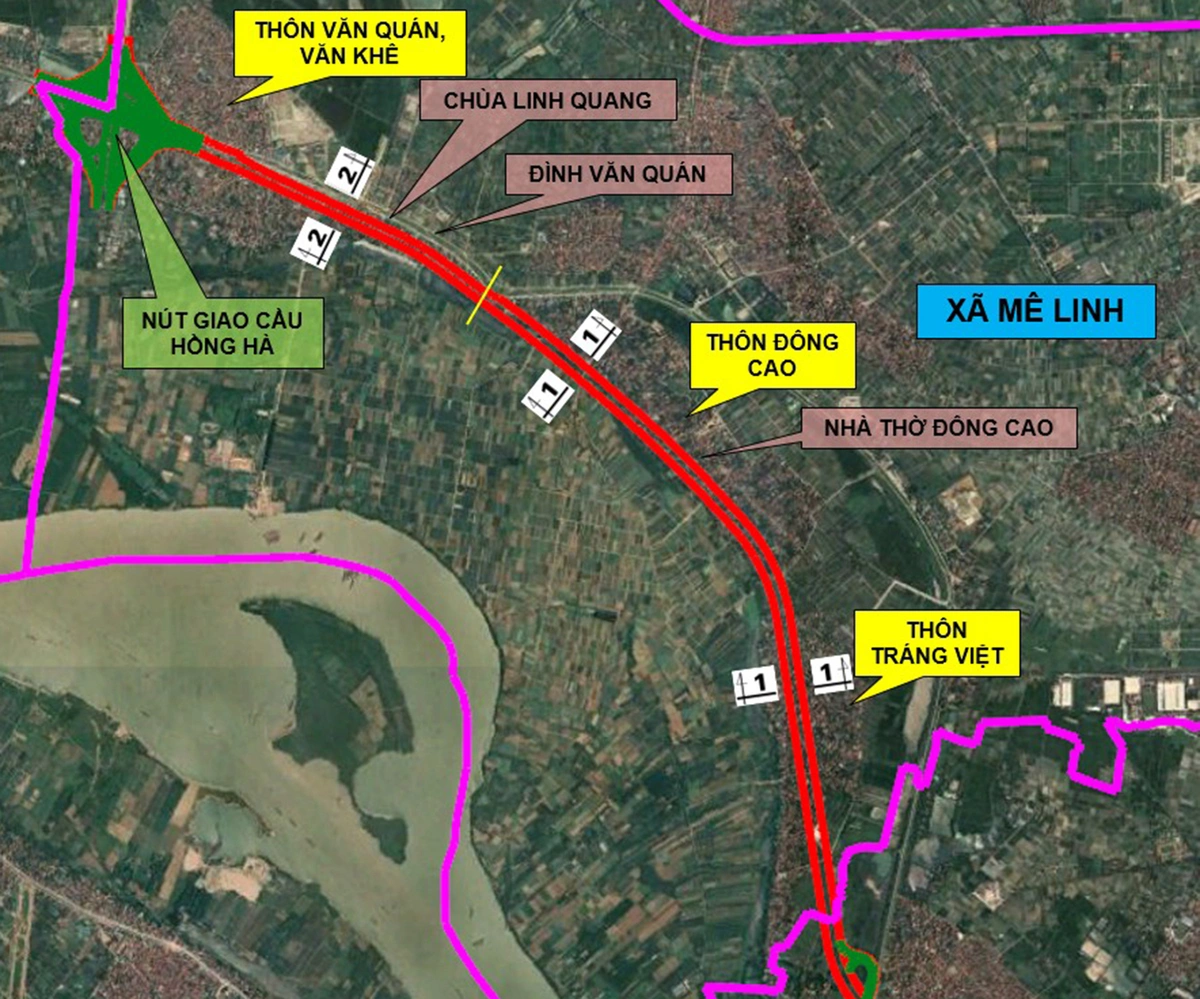
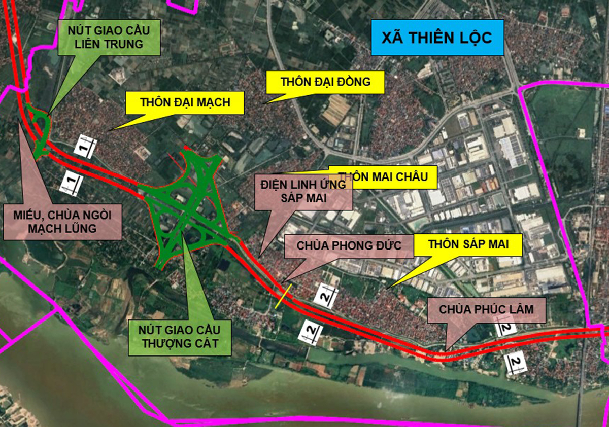
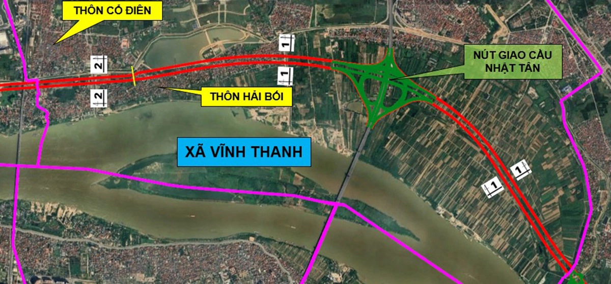
The Ta Hong route, spanning approximately 35 kilometers, is planned to traverse seven administrative districts and wards, starting from the intersection with the Hong Ha Bridge and terminating in Bat Trang commune. This route encompasses areas including Me Linh, Thien Luc, Vinh Thanh, Dong Anh, Bac Dau, Long Bien, and Bat Trang. The design strategy varies throughout the route to accommodate existing structures and protected sites, such as the Linh Quang pagoda and the Van Quan temple, necessitating strategic detours and varying road widths ranging from 54 meters to 73.5 meters.
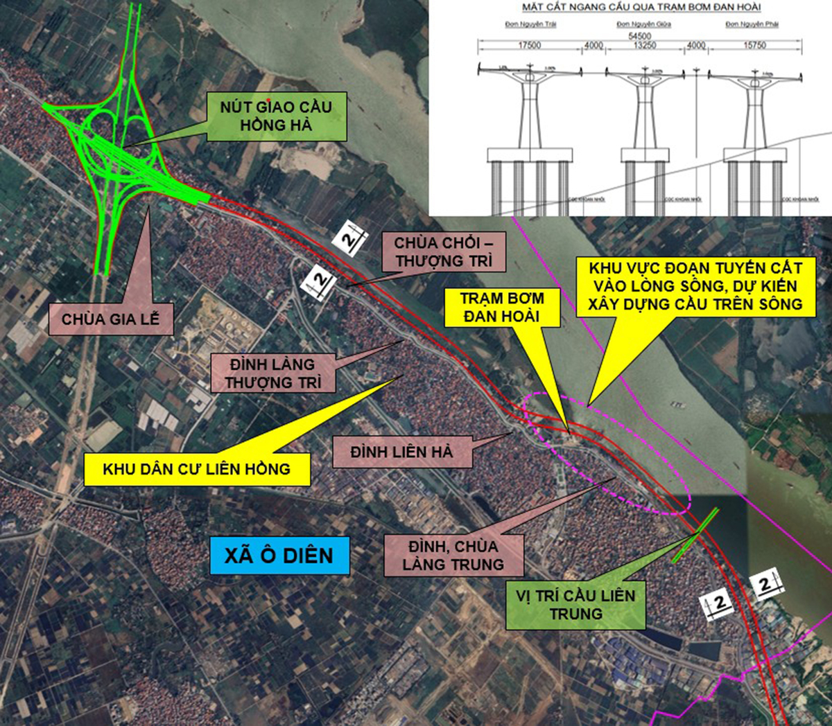
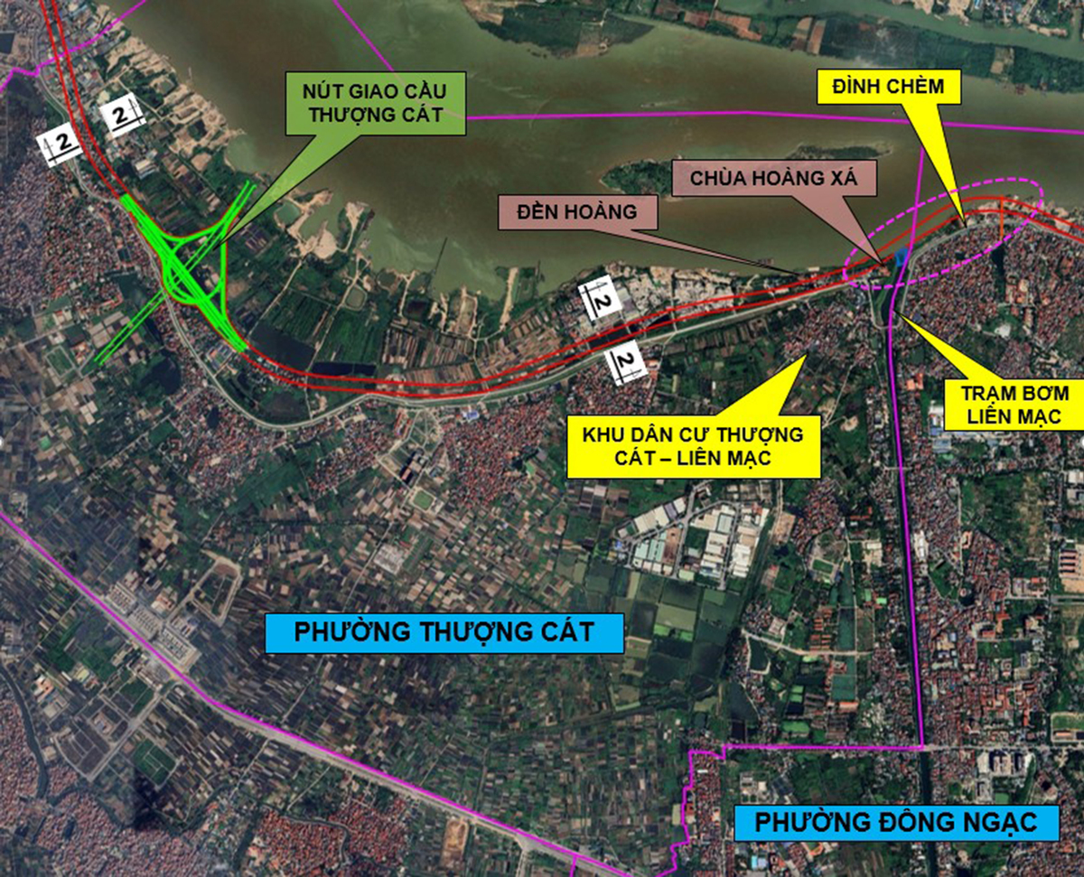
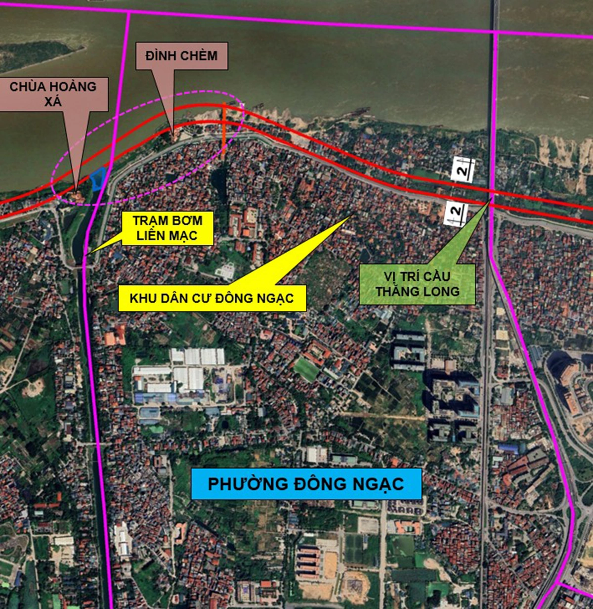
In contrast, the Huu Hong route covers a more extensive 45.43 kilometers, passing through nine administrative units, including O Dien, Thuong Cat, Dong Ngac, Phu Thuong, Hong Ha, Linh Nam, Thanh Tri, Nam Phu, and Hong Van. This route begins at the Hong Ha Bridge junction and extends to the Me So Bridge. Given its length and the density of the urban areas it traverses, the Huu Hong corridor faces complex engineering challenges, particularly regarding the integration of existing levee systems and the preservation of heritage sites like the Chuoi and Thuong Tri temples.
The Strategic Importance of the Red River Corridor
The Red River has long been the lifeblood of Hanoi, serving as both a natural barrier and a conduit for trade and culture. However, rapid urbanization over the past two decades has led to fragmented development along its banks. The current planning proposal seeks to address this by creating a cohesive landscape that serves multiple purposes: transportation efficiency, flood mitigation, and public recreation.
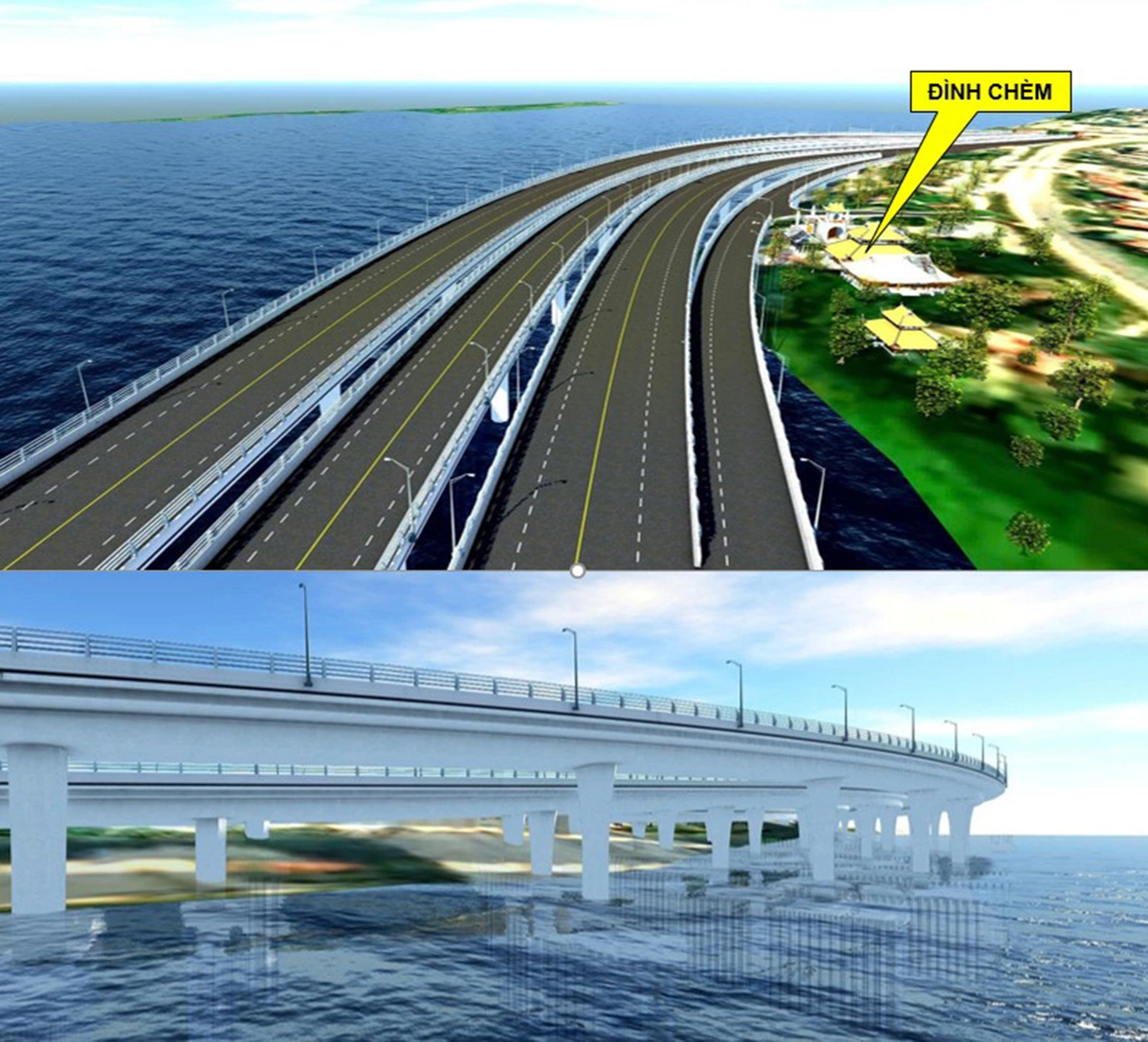
Historically, urban development in Hanoi has often been constrained by the strict requirements of the dike protection zones. The new plan introduces an innovative approach, proposing "bridge-tunnel" hybrid solutions and strategic detours that allow the road network to bypass critical heritage sites while maintaining the integrity of the river’s flow. By incorporating these engineering solutions, the committee aims to minimize the displacement of local populations and preserve the cultural tapestry of the riverside communities.
Chronology of the Planning Process
The development of this master plan has been a multi-year effort involving input from urban planners, environmental experts, and municipal authorities.
- Early 2024: Initial feasibility studies and environmental impact assessments were commissioned to evaluate the technical requirements of the riverside roads.
- Late 2025: Drafting of the 1/5,000 scale urban zoning plan, establishing the fundamental framework for the project.
- Q2 2026: Finalization of the 1/500 scale detailed master plan, incorporating site-specific adjustments for heritage preservation and traffic flow.
- September 2026: Official commencement of the public consultation period, inviting feedback from residents and stakeholders to ensure transparency and community inclusion.
Data-Driven Development
The project’s scale is underscored by the significant land area involved. The Ta Hong route is expected to impact roughly 341.4 hectares of land, with varying levels of intensity depending on the district. For instance, the section passing through Me Linh accounts for approximately 67.59 hectares, while the Thien Luc section covers 82.25 hectares. These figures highlight the necessity for a meticulous land-clearing and compensation strategy to ensure the project remains on schedule without causing undue socio-economic disruption.
On the Huu Hong side, the impact is similarly substantial. The route through O Dien is projected to affect 60.66 hectares, while the section traversing the densely populated Linh Nam ward requires the management of 50.6 hectares of land. These figures are not merely administrative metrics; they represent the complexities of land acquisition in one of Vietnam’s most dynamic urban environments.
Official Responses and Public Engagement
The Hanoi People’s Committee has emphasized that the current 20-day consultation period is a critical phase of the decision-making process. Officials from the Institute of Construction Planning of Hanoi, who provided the foundational technical data, have noted that the project is designed to be "future-proof," taking into account projected population growth and the need for improved connectivity between the two banks of the Red River.
Local residents and business owners have expressed cautious optimism regarding the project. Many see the potential for increased property values and improved accessibility, while others have voiced concerns regarding the potential relocation of homes and small businesses that have occupied the riverside for generations. The municipal government has pledged to implement a fair compensation framework that adheres to national land laws, promising that the resettlement process will be handled with social sensitivity.
Broader Implications and Future Outlook
The implications of the Red River corridor plan extend far beyond mere road construction. If successfully implemented, the project will serve as a catalyst for urban renewal, potentially unlocking hundreds of hectares of high-value land for development, green spaces, and public facilities.
- Environmental Impact: By formalizing the riverfront, the city hopes to curb illegal construction and pollution, creating a managed environment that supports biodiversity and improves the river’s water quality.
- Economic Growth: Improved road connectivity will significantly reduce traffic congestion in the city center, facilitating more efficient movement of goods and people between Hanoi’s eastern and western districts.
- Urban Resilience: The integration of the road network with the dike system provides a modernized approach to flood protection, essential given the increasing unpredictability of extreme weather events in the region.
As the public consultation window progresses, the city’s urban planners are preparing to synthesize the feedback into the final implementation document. The success of this project will likely serve as a blueprint for future urban infrastructure initiatives in Vietnam, demonstrating how large-scale, transformative development can coexist with environmental stewardship and the preservation of historical identity.
In conclusion, the Red River landscape and urban corridor project represents a bold step forward for Hanoi. While the technical and logistical challenges remain considerable, the plan provides a clear vision for a more integrated, efficient, and livable capital city. As Hanoi continues to assert itself as a major regional economic hub, the ability to effectively manage and utilize its natural assets will be a defining factor in its long-term sustainable development. The next several months will be crucial as the city moves from the conceptual planning phase toward the complex realities of execution, with all eyes on how the administration balances growth with the preservation of the Red River’s enduring legacy.