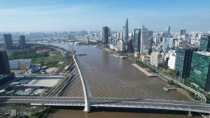
Ho Chi Minh City and the wider Southern region of Vietnam are bracing for a critical period of severe weather as expanding convective cloud systems merge with exceptionally high seasonal tides. Meteorological authorities have issued urgent warnings regarding widespread inundation, structural risks, and transportation disruptions across urban centers and low-lying rural communities. The combination of intense afternoon downpours and peak astronomical high tides threatens to push water levels significantly above alarm thresholds, repeating a recurring seasonal crisis that strains regional infrastructure and local disaster management frameworks.
Meteorological Evolution and Atmospheric Dynamics
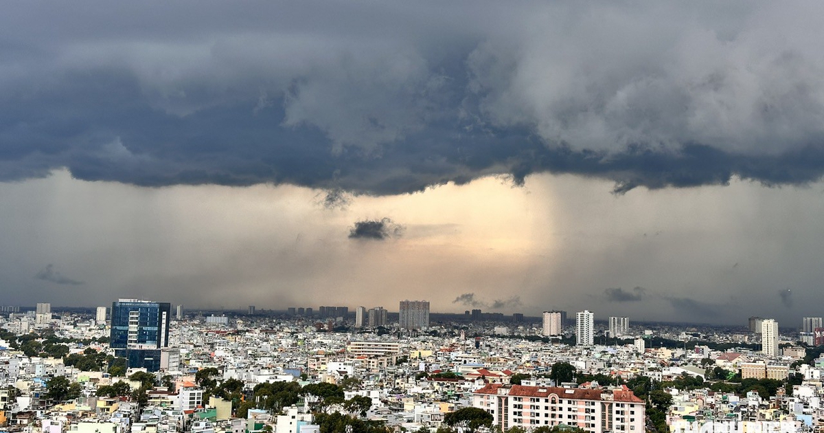
According to the Southern Regional Hydrometeorological Station, towering cumulonimbus clouds have developed rapidly over the skies of Ho Chi Minh City and multiple neighboring provinces. These atmospheric disturbances are driven by prevailing seasonal monsoon patterns interacting with localized convergence zones, generating heavy rainfall, violent localized gusts, and sudden downpours.
Beyond Ho Chi Minh City, the storm cells have heavily impacted Lam Dong, Dong Nai, Tay Ninh, Dong Thap, Vinh Long, Can Tho, and An Giang. While short-term forecasts indicate a brief interlude of clearer skies and morning sunshine on September 27 and 28—with rainfall expected to contract and shift mostly to scattered afternoon and evening showers—the respite from atmospheric precipitation will do little to alleviate the impending hydrological pressure.
As atmospheric rains temporarily subside, the underlying tidal forces are surging to dangerous peaks. The convergence of heavy stormwater runoff and swelling river basins creates a compounding hydraulic effect, severely restricting the natural drainage capacity of urban canals and river networks.
Chronology and Tidal Progression
The ongoing tidal surge corresponds to the major astronomical high tide of the eighth lunar month, a recurring phenomenon historically known for producing some of the highest water levels of the year. The progression of water levels along the Saigon River and the Mekong Delta tributaries has followed an alarming upward trajectory throughout late September.
On the morning of September 26, key monitoring stations recorded water levels that immediately signaled a severe flood event. The peak water level on the Saigon River at the Phu An station surpassed Alarm Level 1, while the Nha Be station hovered dangerously close to Alarm Level 2. Further upstream, the Thu Dau Mot station approached the critical threshold of Alarm Level 3.
Hydrologists predict that the peak of this current tidal cycle will occur between September 28 and 30. Projections for the Phu An and Nha Be stations indicate that peak water heights will reach between 1.60 and 1.65 meters, matching or exceeding Alarm Level 3 by approximately 3 centimeters. Meanwhile, the Thu Dau Mot station is expected to peak between 1.75 and 1.85 meters, surpassing Alarm Level 3 by an estimated 15 to 25 centimeters. Daily tidal surges are anticipated to peak twice a day during regular windows from 6:00 AM to 8:00 AM and from 5:00 PM to 7:00 PM, compounding morning rush-hour traffic and evening commutes.
Detailed Regional Impact Across the Mekong Delta
The hydrological threat extends far beyond the metropolitan boundaries of Ho Chi Minh City, striking deep into the heart of the Mekong Delta along the primary channels of the Tien and Hau rivers.
In Can Tho, morning water levels along the Hau River reached 2.0 meters, officially touching Alarm Level 3. Simultaneously, the My Thuan station on the Tien River recorded a water level of 1.93 meters, exceeding Alarm Level 3 by 13 centimeters.
Forecast models indicate that the peak tides on the Hau River in Can Tho will climb further to between 2.10 and 2.15 meters, exceeding Alarm Level 3 by 10 to 15 centimeters. Along the Tien River, water levels at My Thuan are projected to reach 2.0 to 2.05 meters, surpassing Alarm Level 3 by 20 to 25 centimeters. Consequently, the Department of Hydro-Meteorological Forecasting has elevated the natural disaster risk level for the downstream areas of the Tien and Hau rivers to Level 2.
Authorities emphasize that these figures represent some of the highest recorded water levels of the annual cycle, posing direct threats to riverside agricultural plots, aquaculture facilities, and densely populated residential quarters lacking adequate flood barriers.
Infrastructure Vulnerabilities and Drainage Bottlenecks
The convergence of heavy rainfall and maximum astronomical tides exposes chronic vulnerabilities in urban drainage systems and river embankments. When intense rainfall coincides precisely with peak tidal heights, urban discharge points become entirely submerged. Under such conditions, stormwater cannot drain via gravity into swollen rivers and canals, forcing water backward through drainage pipes and manholes onto urban thoroughfares.
Low-lying urban quarters, riverside promenades, and commercial thoroughfares with limited drainage capacity face immediate inundation. Neighborhoods situated in districts adjacent to major waterways, as well as poorly graded interior city sectors, experience rapid flooding that transforms major roadways into impassable water corridors. The resulting stagnation disrupts public transportation, stalls vehicular traffic, damages private and commercial property, and increases the risk of electrical hazards and waterborne sanitation issues.
Official Disaster Response and Preparedness Measures
In response to the escalating forecasts, regional disaster prevention committees, municipal departments, and local people’s committees across Ho Chi Minh City and the southern provinces have activated emergency preparedness protocols.
Local authorities have mobilized rapid response teams to inspect vulnerable river dykes, operate sluice gates, and deploy high-capacity mobile pumps in chronically flooded zones. Traffic police and urban management units are deployed at major intersections and known flood hotspots to direct traffic, clear debris blocking drainage grates, and assist stranded motorists.
Public advisories have been broadcast through local media channels and digital platforms, urging residents in low-lying, riverside, and flood-prone areas to elevate valuable household goods, secure electrical appliances, and monitor real-time hydrological updates. Municipal agencies have also recommended that commuter schedules be adjusted where possible to avoid peak tidal and rainfall windows.
Socioeconomic Implications and Long-Term Adaptation
The recurring intersection of high tides, heavy rainfall, and land subsidence presents profound socioeconomic challenges for southern Vietnam. Beyond immediate property damage and productivity losses, recurring urban flooding disrupts supply chains, damages municipal asphalt and concrete infrastructure, and imposes heavy financial burdens on local governments tasked with continuous infrastructure maintenance and flood mitigation engineering.
Economists and environmental planners note that while short-term emergency responses are essential for saving lives and minimizing property loss, long-term regional resilience requires comprehensive adaptation strategies. These include expanding retention basins, upgrading wastewater and drainage networks, constructing robust tidal barrier systems, strictly enforcing zoning laws along natural floodplains, and addressing the underlying causes of land subsidence driven by groundwater extraction.
As the region navigates the current peak of the eighth lunar month tidal cycle, coordinated vigilance among citizens, municipal planners, and meteorological agencies remains the primary line of defense against the mounting forces of nature.
Related posts: