Tropical Depression Threatens Mekong Basin as Floodwaters Surge Across Cambodia and the Mekong Delta

The mainstream water levels of the Mekong River at the Kratie station in Cambodia are currently maintaining a remarkably high elevation and exhibiting an upward trajectory, driven heavily by heavy precipitation linked to an approaching tropical depression making landfall in central Vietnam. According to the Southern Institute of Water Resources Research (SIWRP), this meteorological shift is exerting direct pressure on water dynamics throughout the lower Mekong basin, compounding seasonal flood concerns for communities downstream.
As hydrological authorities closely monitor the situation, the convergence of upstream floodwaters, tidal surges, and regional tropical disturbances has elevated the urgency for disaster preparedness across both Cambodia and the Mekong Delta in Vietnam. The ongoing weather events underscore the delicate and interconnected vulnerability of mainland Southeast Asia’s primary river basin to shifting weather patterns, climate variability, and localized storm systems originating over the South China Sea.
Hydrological Situation at Kratie and Upstream Dynamics
The hydrological monitoring station at Kratie, Cambodia, serves as a critical bellwether for assessing the volume of water moving down the lower mainstream of the Mekong River toward the delta region in Vietnam. By the morning of September 12, water levels at Kratie reached 21.22 meters. This reading marks a significant deviation from historical averages, standing 2.22 meters above the multi-year average for the same period and surpassing the corresponding water levels recorded in 2025 by 1.39 meters.
The surge at Kratie is primarily attributed to continuous rainfall generated by moisture channels and low-pressure systems moving across the Indochina peninsula. Although the approaching tropical depression is expected to deliver heavy downpours that are relatively narrow in geographic scope and of short duration, the accumulated runoff is sufficient to sustain elevated water heights along the Cambodian stretch of the river. Hydrologists note that while the rate of increase may taper off slightly following the dissipation of the immediate storm impacts, the sheer volume of water already present ensures that levels will remain high throughout the middle of September.
Mekong Delta Headwaters and Tidal Interactions
Further downstream in the Mekong Delta, the headwaters at Tân Châu and Châu Đốc are experiencing strong upward trends driven by the dual pressures of upstream flood discharges and high seasonal tides. By the morning of September 12, the peak water level at the Tân Châu station reached 3.52 meters—0.23 meters above the multi-year average. Simultaneously, the station at Châu Đốc recorded a level of 3.11 meters, exceeding its historical average by 0.17 meters.
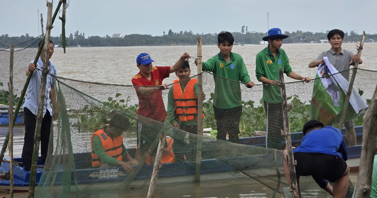
This hydraulic pressure coincides with the peak of the early-August lunar tide cycle, which has pushed inland waters across the delta into various alert thresholds. In the lower reaches of the delta, water levels are hovering around Alarm Level 1, while mid-region areas are recording levels fluctuating between Alarm Level 2 and Alarm Level 3. In certain localized low-lying zones, water heights have even surpassed Alarm Level 3, threatening localized inundation of agricultural plots, rural infrastructure, and transport routes.
According to forecasts compiled by SIWRP and regional meteorological agencies, water levels at Tân Châu and Châu Đốc are projected to climb further over a two-to-three-day window, potentially peaking between 3.55 and 3.6 meters at Tân Châu and between 3.15 and 3.2 meters at Châu Đốc. Following these peaks, water levels are anticipated to experience a slow, variable decline dictated primarily by diurnal tidal cycles rather than sudden upstream reductions.
Meteorological Context: The Role of South China Sea Storm Systems
The active weather pattern influencing the Mekong basin is part of a broader tropical cyclonic season over the South China Sea. Meteorological organizations, both domestic and international, have continuously tracked the formation and movement of tropical depressions and low-pressure areas making landfall along the central coast of Vietnam, stretching from Hà Tĩnh down to Quảng Trị.
While these meteorological disturbances primarily target central Vietnam with torrential downpours exceeding 350 to 400 millimeters in localized zones, their outer cloud bands and associated atmospheric troughs extend deep into the Indochina interior. This spatial distribution funnels moisture directly into the lower Mekong basin, triggering intense precipitation events that instantly augment surface runoff into tributaries and eventually swell the mainstream river channels.
Climatological models indicate that this active phase is not an isolated incident. Projections extending from the present through mid-October suggest that the South China Sea will remain conducive to the formation of tropical storms and depressions. Consequently, the lower Mekong basin remains vulnerable to secondary and tertiary flood pulses triggered by late-season meteorological events well into the autumn months.
Official Warnings and Local Preparedness
In response to the compounding risks of upstream floodwaters and high coastal tides, local authorities, provincial disaster management committees, and agricultural extension offices across the Mekong Delta have elevated their alert statuses. Government agencies are urging local populations, particularly farming and aquaculture communities residing in flood-prone tracts and unprotected riparian zones, to maintain continuous vigilance and adapt their production schedules.

Local governments have initiated several precautionary measures:
- Infrastructure Inspection: Reinforcing local dykes, sluice gates, and canal embankments to prevent accidental breaching during high tide and flood peaks.
- Agricultural Safeguards: Advising farmers to expedite the harvesting of mature or early-season rice crops in low-lying fields to minimize potential flood-related crop losses.
- Public Communication: Disseminating real-time hydrological bulletins through local broadcast media and digital messaging platforms to keep communities informed of impending water level changes.
- Emergency Preparedness: Positioning response teams, rescue equipment, and essential supplies in vulnerable districts to address potential flash flooding or rapid riverbank erosion.
Broader Implications for Agriculture and Ecosystems
The current hydrological regime carries mixed implications for the socio-economic and ecological landscape of the Mekong Delta. On one hand, higher floodwaters bring vital alluvial sediment, revitalize freshwater fisheries, and help flush out accumulated salinity and agricultural pollutants from delta soils—ecosystem services that are essential for the long-term sustainability of the region’s agricultural productivity.
On the other hand, rapid surges combined with astronomical tides present immediate operational challenges. Unprecedented water heights increase the stress on secondary and tertiary flood-prevention dyke systems, which were primarily designed to protect triple-rice cropping zones. If water levels exceed structural design parameters, unplanned overtopping can lead to localized property damage, disruption of rural logistics, and temporary displacement of residents.
As the Mekong basin navigates the peak weeks of the flood season, scientists and water resource managers emphasize the necessity of cross-border data sharing and integrated regional planning. With changing climate dynamics increasing the frequency of intense, erratic weather events, real-time monitoring and adaptive governance remain the primary lines of defense for millions of inhabitants whose livelihoods depend upon the predictable rhythms of Southeast Asia’s greatest river.
Related posts: