Navigating the Gridlock: Ho Chi Minh City Faces Unprecedented Traffic Pressures Amid Accelerated Urban Infrastructure Development

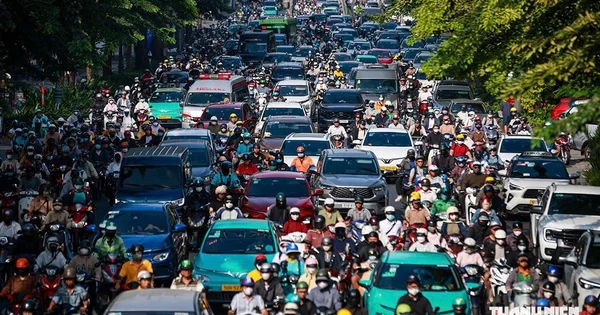
Ho Chi Minh City is currently experiencing a profound infrastructural transition, characterized by simultaneous large-scale construction projects that have fundamentally altered urban mobility. As municipal authorities accelerate the development of strategic mass transit systems and road networks, citizens find themselves contending with widespread congestion, extended travel times, and complex logistical challenges. This phase of intensive construction, while vital for the city’s long-term economic and structural evolution, has imposed severe strain on daily commuters and local commerce alike.
The Roots of Urban Congestion and Construction-Induced Bottlenecks
The contemporary traffic strain across Ho Chi Minh City is largely driven by the implementation of major transit initiatives, most notably Metro Line 2, which connects Ben Thanh to Tham Luong. In recent months, the erection of extensive construction hoardings and site barriers has significantly narrowed arterial roadways. Major intersections, such as the junction of Cach Mang Thang Tam and Nguyen Thi Minh Khai, have been partially restricted to accommodate underground station development. This has created severe bottleneck effects, forcing vehicular traffic into narrow corridors where automobiles and motorcycles contend for every centimeter of space.
For thousands of commuters traveling from outlying districts into the city center, the daily commute has transformed into an endurance test. Arterial routes traditionally designed to handle moderate volumes—such as Nguyen Dinh Chieu, Vo Van Tan, and various feeder roads in Districts 3 and 4—are now absorbing spillover traffic from blocked primary corridors. Consequently, peak-hour congestion, which was previously confined to specific morning and evening windows, now stretches across longer durations, severely impacting productivity and increasing transportation costs.
Economic Impacts and Daily Realities for Commuters
The ripple effects of accelerated infrastructure development extend far beyond mere inconvenience, directly impacting the daily operational costs of urban living and commerce. Commuters utilizing ride-hailing services or taxis report substantially higher fares, driven by longer detour routes and prolonged idling in traffic. Drivers are frequently forced to navigate circuitous pathways to bypass cordoned-off zones, adding significant mileage to standard trips and increasing fuel consumption.
Local businesses situated near major construction corridors also report logistical hurdles. Delivery schedules have become unpredictable, and customer foot traffic has experienced fluctuations as accessing central commercial zones grows increasingly arduous. The situation is particularly acute for residents commuting from southern gateways, such as Nha Be, to central business districts, where bottlenecks at key transit points like Nguyen Huu Tho and the Khanh Hoi Bridge compound daily transit times.
Strategic Scheduling and the Upcoming Peak Transport Season
Municipal transportation authorities acknowledge that the current conditions represent a critical operational challenge, particularly as the city approaches the year-end peak season for travel and commercial freight distribution. Over the coming months, construction activities related to the 11 underground stations of Metro Line 2, alongside several inter-provincial rail and road initiatives, are slated to expand. This concentration of concurrent projects means that urban traffic management will face sustained pressure.
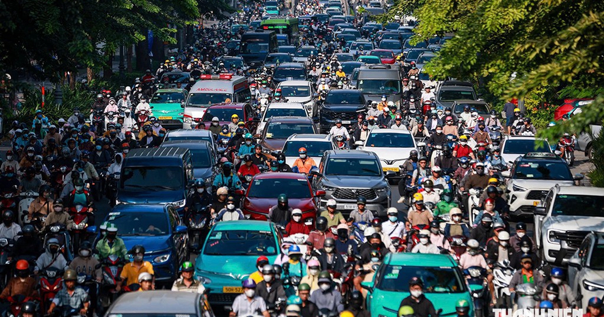
According to projections from the Management Authority for Urban Railways (MAUR), the simultaneous execution of multiple strategic projects is a necessary milestone. However, the density of these work zones requires continuous inter-agency coordination between transport planners, municipal departments, and traffic police to prevent gridlock from paralyzing key economic corridors.
Mitigation Strategies and Emergency Traffic Management
In response to mounting public concern, municipal authorities have implemented targeted mitigation strategies designed to optimize traffic flow around construction zones. Along critical stretches of Truong Chinh Street, from Tay Thanh to Cong Hoa, authorities have removed fixed concrete medians and replaced them with movable barriers and flexible delineators. This adaptive infrastructure allows traffic management personnel to dynamically adjust lane allocations based on real-time directional volume during morning and evening rush hours.
Furthermore, the Ho Chi Minh City Traffic Police Department (PC08) and local youth volunteer units have increased their presence at high-density intersections. Traffic signals have been retimed, and auxiliary personnel are deployed to manage manual diversions and clear blockages promptly. These interventions have reportedly brought a degree of stability to previously volatile corridors, preventing the absolute gridlock that marked the initial weeks of deep-zone construction.
Expert Perspectives on Long-Term Urban Mobility
Urban planning experts emphasize that enduring periods of disruption are an unavoidable aspect of transitioning toward a modern, high-capacity public transit network. Dr. Pham Viet Thuan, Director of the Ho Chi Minh City Institute of Economy and Natural Resources, notes that comprehensive infrastructure growth requires the city to absorb short-term congestion as an investment in future urban efficiency. Rather than attempting to eliminate traffic friction entirely, the objective must shift toward effective gridlock management to minimize socioeconomic impacts.
To address these long-term challenges, urban analysts advocate for structural overhauls in traffic management and mobility planning. Key proposals include the widespread deployment of AI-driven adaptive traffic signal systems, replacing static countdown timers with sensors that dynamically extend green phases for high-volume directions. Additionally, the implementation of "green wave" coordination across major corridors—such as Nam Ky Khoi Nghia and Nguyen Thi Minh Khai—aims to allow vehicles moving at designated speeds to encounter sequential green lights, thereby reducing idling times and vehicular emissions.
Future Outlook and the Vision for Sustainable Transit
As Ho Chi Minh City continues its trajectory toward becoming a modernized metropolitan hub, the success of its infrastructure strategy will depend on the synergy between construction execution and public transit expansion. City planners stress that the ultimate solution to chronic congestion lies in reducing reliance on private vehicles through the rapid completion of an integrated public transportation network. By ensuring that high-capacity rail systems and feeder bus networks provide comprehensive coverage within accessible pedestrian radii, municipal authorities anticipate a natural stabilization of private vehicle acquisition over the coming decade.
For the immediate future, however, the city remains a vast construction site where resilience, adaptability, and proactive traffic management are essential. As public and private stakeholders navigate this critical development phase, the overarching goal remains clear: balancing the urgent demands of rapid urbanization with the day-to-day mobility needs of millions of residents.