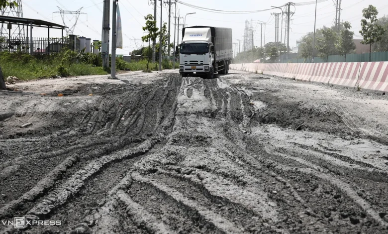
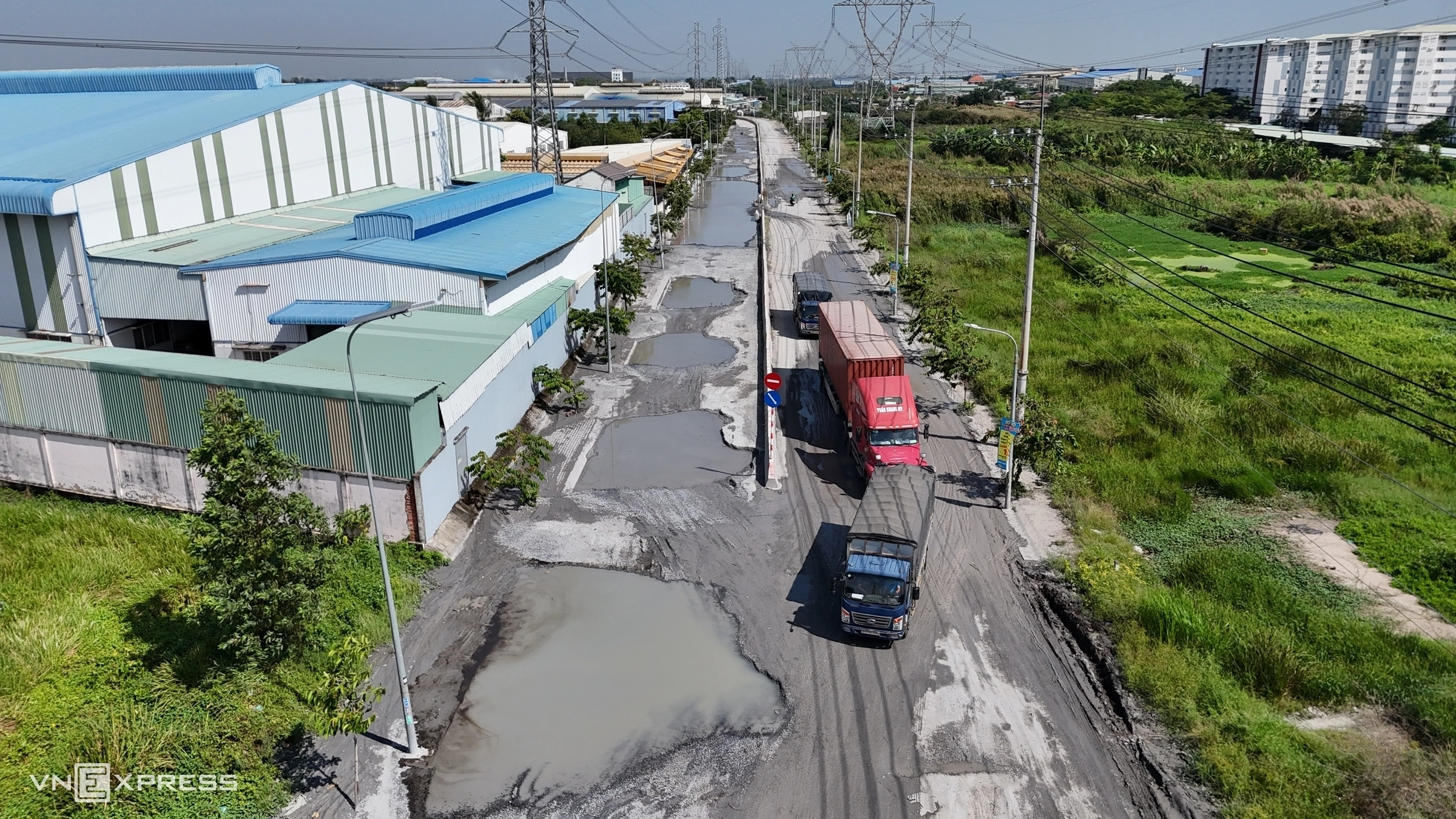
The Kanh Tay road, a vital 8-kilometer transport artery connecting National Highway N2 to major industrial zones in Tay Ninh province, has become a treacherous gauntlet for commuters and freight drivers. As of late October 2026, the thoroughfare has fallen into a state of severe disrepair, characterized by hundreds of deep potholes—colloquially referred to as "elephant craters"—and persistent flooding that has effectively paralyzed transit for heavy vehicles and passenger cars alike.
Current Status and Infrastructure Failure
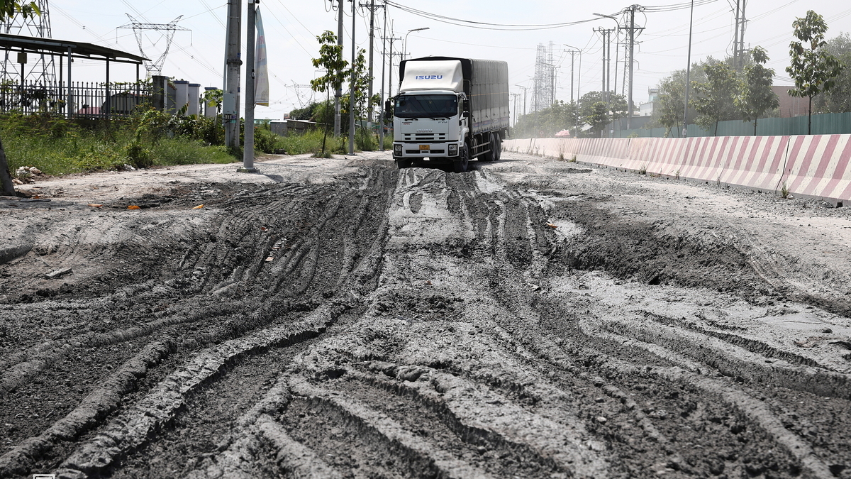
For the past several days, the condition of Kanh Tay Road (formally designated as DT 823B) has deteriorated to an alarming degree. The most critical section, a 2-kilometer stretch near the intersection with Provincial Road 824, has been transformed into a mire of stagnant water and exposed sub-base material. This segment serves as a primary logistical corridor for industrial transport, yet the structural integrity of the road has completely collapsed under the weight of heavy traffic and seasonal environmental pressures.
Motorists navigating this corridor are now forced into dangerous maneuvers, often veering into the opposing lane to circumvent the deepest craters, some of which exceed a depth of nearly one meter. The situation has led to a near-total cessation of standard traffic flow, with many drivers opting to perform U-turns rather than risk mechanical failure or being stranded in the middle of the road.
The Logistical Bottleneck
The Kanh Tay Road was designed as a strategic shortcut to optimize logistics for the industrial hubs located in the former Duc Hoa district, now integrated into the infrastructure network of Tay Ninh. Spanning four lanes with a total surface width of 16 meters and a foundation width of 22 meters, the road was intended to shave off more than 10 kilometers of travel compared to the traditional routes via National Highway 22 and National Highway 1.
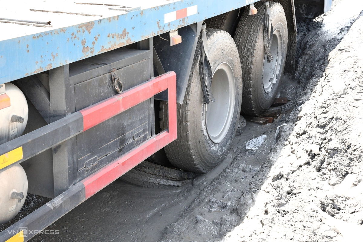
However, the current state of the road has rendered these efficiency gains obsolete. On October 27, 2026, around 9:00 AM, a heavy truck operated by driver Tran Xuan Dong became mired in the mud after following navigation software (Google Maps) intended to bypass traffic congestion on National Highway 1. Despite over two hours of attempts to extricate the vehicle, the driver was forced to call for emergency towing services. This incident was not isolated; at the same time, another heavy goods vehicle transporting footwear materials became stuck, effectively sealing the road and creating a bottleneck that forced nearly a dozen other vehicles to abandon their route and seek alternative, albeit longer, paths.

A Chronology of the Crisis
The degradation of the road is not a sudden phenomenon but rather the result of cumulative wear and tear coupled with inadequate drainage capacity. Local reports indicate that the following timeline highlights the progression of the crisis:
- Mid-October 2026: Increased seasonal rainfall begins to expose the weakened structural layers of the road surface.
- October 26, 2026: Minor ponding is reported, which quickly escalates into significant cratering as heavy industrial traffic continues to pass through.
- October 27, 2026: Major logistical failures occur, with multiple heavy trucks becoming immobilized, prompting social media reports and local media coverage.
- October 28-29, 2026: Local authorities begin initial assessments, while commuters are forced to navigate the area with extreme caution, using sticks to probe water depths before driving through.
Infrastructure Analysis and Future Implications
The failure of Kanh Tay Road highlights a critical vulnerability in the regional industrial support network. The road was intended to serve as a high-capacity link for the supply chains of various manufacturing sectors, including leather goods, textiles, and electronics. When such a critical artery fails, the immediate economic impact includes delays in shipment schedules, increased fuel consumption for vehicles forced to take detours, and higher maintenance costs for transport companies due to vehicular damage.

Furthermore, the environmental factors—specifically the inadequate drainage system—suggest that the road’s construction may not have accounted for the increasing volume of heavy-load traffic combined with the regional rainfall patterns. The reliance on Google Maps by drivers seeking to avoid traffic on National Highways has inadvertently funneled high-tonnage vehicles onto a road surface that was likely never engineered for such sustained, heavy-duty pressure.
Official Response and Remediation Plans
According to statements from the Department of Construction of Tay Ninh, the provincial government is aware of the deteriorating conditions. Officials have confirmed that the Kanh Tay road project is currently undergoing the procurement and planning phases for an comprehensive upgrade and rehabilitation.

The proposed plan involves:
- Structural Elevation: Raising the road grade to mitigate the risk of flooding.
- Drainage Reconstruction: The excavation of new canal systems and the installation of large-scale box culverts to facilitate water runoff.
- Surface Reinforcement: Replacing the current degraded layers with more resilient asphalt composites designed for heavy-vehicle transit.
While the plans for repair are in motion, the immediate concern remains the safety of the local population and the continuity of regional commerce. Authorities have advised transport companies and commuters to avoid the route until emergency patches can be completed.
Broader Socio-Economic Impact
The "elephant crater" crisis on Kanh Tay Road serves as a sobering case study on the necessity of proactive infrastructure maintenance. In the context of Vietnam’s rapidly expanding industrial zones, the ability to move goods reliably is as important as the manufacturing capacity itself. When transport links are severed, the entire regional supply chain experiences a ripple effect.
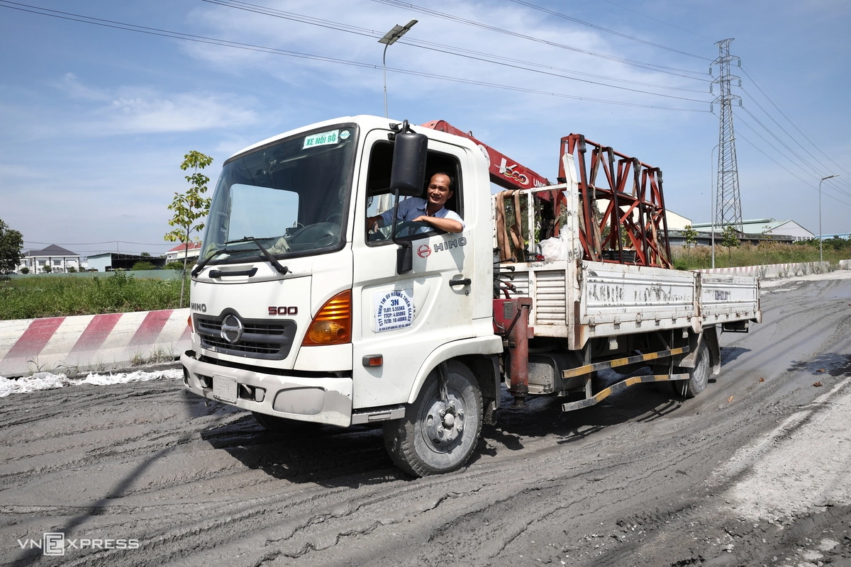
For the local residents and the workforce of the industrial zones, the road has become a daily hazard. Motorcyclists, who are particularly vulnerable, are frequently forced to ride along the very edge of the road or against traffic to avoid the deeper sections of water. This creates a high risk of traffic accidents.
As the province moves toward the implementation of the repair project, there is a clear demand from stakeholders for a more robust monitoring system for road infrastructure. The reliance on legacy designs in an era of rapid industrialization is a point of contention that local planners must address if they are to maintain Tay Ninh’s attractiveness as a hub for investment and manufacturing.
In the short term, the sight of trucks mired in mud remains a stark reminder of the gap between infrastructure development and the demands of modern economic activity. Until the planned upgrades are fully realized, the stretch of Kanh Tay Road near Provincial Road 824 will remain a symbol of the challenges faced by the region’s logistics sector during the monsoon season.