
Comprehensive Regional Weather Outlook: Northern Sunshine, Central Heavy Rains, and Southern Tidal Flooding Expected Through Late October

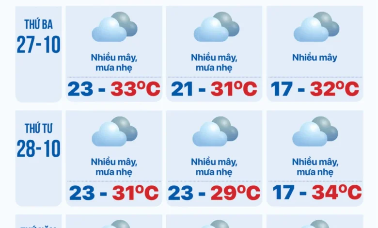
The meteorological landscape across Vietnam is presenting a stark regional division as the month of October draws to a close. According to the National Center for Hydro-Meteorological Forecasting, shifting weather patterns are bringing simultaneous extremes to different parts of the country, ranging from early-morning fog and bright sunshine in the north, to torrential downpours across the central provinces, and a combination of afternoon thunderstorms and high seasonal tides in the south. These diverse weather phenomena require targeted preparedness measures from local authorities and residents alike as regional communities navigate the transitional climate phases characteristic of late autumn.
Northern Weather Patterns: Morning Fogs Give Way to Clear Skies and Isolated Showers
In the northern provinces, the atmospheric conditions this week are defined by a classic seasonal transition. Early mornings are routinely blanketed by light mists and localized fog, particularly in low-lying areas and mountainous terrain, significantly reducing horizontal visibility for early commuters and regional transportation networks. However, as the morning progresses, these vapours quickly dissipate, yielding to prolonged periods of sunshine and stable atmospheric pressure.
Despite the daytime warmth, forecasters note that localized atmospheric disturbances will briefly interrupt the stable conditions. On approximately October 26 and again around October 29, minor cold air infusions or upper-level convergence zones are expected to trigger scattered showers and thunderstorms in select localities. While these precipitation events are projected to be relatively brief, they underscore the volatility of the regional climate during this transitional period. Agricultural communities and commuters in the northern sector are advised to monitor short-term forecasts to account for sudden localized visibility drops and intermittent wet roadways.
Central Vietnam Faces Severe Weather Threats with Heavy Downpours

The most severe weather hazards this week are concentrated along the central coastline, stretching from Thanh Hoa down to the historic city of Huế, as well as the northern sections of the South Central Coast. Meteorological models indicate that a sustained rainy period will take hold from October 26 through October 29, driven by persistent easterly wind surges interacting with regional topography.
During this multi-day window, residents across Thanh Hoa, Nghe An, Ha Tinh, Quang Binh, Quang Tri, and Thua Thien Hue can expect frequent bouts of moderate to heavy rain, with cumulative precipitation totals raising concerns for localized flooding in urban environments and rapid rises in small river basins. Furthermore, the northern part of the South Central Coast—encompassing key coastal provinces—will experience similar heavy downpours and thunderstorms between October 27 and October 29.
In stark contrast, the southern reaches of the South Central Coast will remain largely dry, experiencing warm, sunny days with minimal rainfall interference. Disaster management agencies in the central provinces have issued preliminary warnings for flash floods in mountainous terrain and severe waterlogging in low-lying urban sectors, urging local disaster response teams to remain on high alert throughout the peak rainfall window.
Southern Vietnam: Afternoon Convection and Rising Tidal Surges
Meanwhile, the southern provinces and the Mekong Delta region are experiencing a dual weather challenge characterized by daytime sunshine interspersed with late-day convective activity, compounded by significant seasonal high tides. The early part of the week will see predominantly sunny conditions across the southern region. However, starting around October 28 and extending through October 29, scattered afternoon and evening showers and thunderstorms are forecast to return with varying intensity.
Meteorologists emphasize that these convective storms carry inherent hazards. Due to strong daytime heating and high regional humidity, the developing rain cells possess the potential to generate severe phenomena, including frequent lightning, sudden gusts of wind, localized squalls, and even the remote possibility of hail. Urban centers such as Ho Chi Minh City are particularly vulnerable to localized street flooding during these heavy downpours, as drainage systems are frequently overwhelmed by rapid accumulations of water.
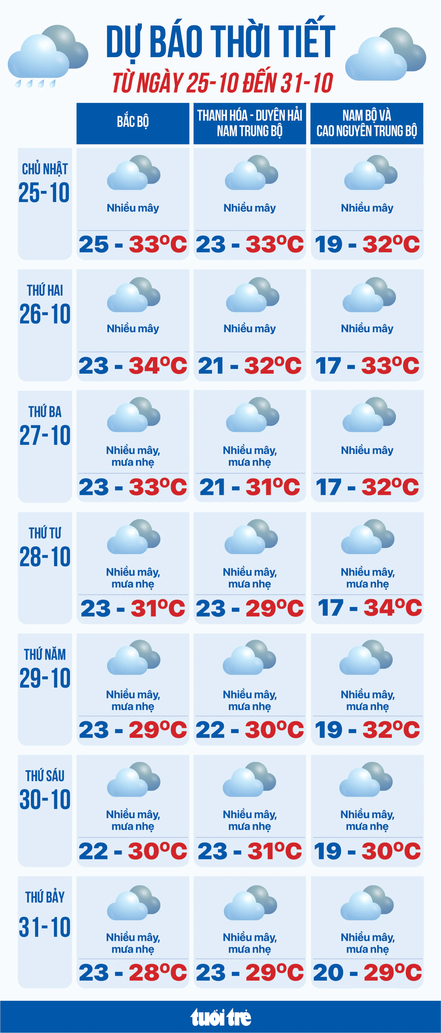
Adding to the complexity of the southern weather outlook, these atmospheric conditions coincide with an ongoing astronomical tidal cycle. The combination of seasonal high tides and potential heavy rainfall significantly increases the risk of coastal and riverine flooding in low-lying and unembanked areas across the southern delta. Local authorities have stepped up advisories for residents living near riverbanks and coastal estuaries, recommending proactive measures to safeguard property, livestock, and commercial inventories against inundation.
Implications and Preparedness for Communities Across Vietnam
The convergence of contrasting weather systems across the country underscores the growing unpredictability of seasonal transitions and the critical importance of early warning systems. While northern agriculture benefits from stable sunshine punctuated by brief moisture, central communities face acute hydrological risks that demand continuous vigilance. In the south, the intersection of urban convective storms and tidal surges highlights the pressing need for resilient municipal infrastructure and comprehensive disaster readiness.
Emergency management officials nationwide reiterate that public adherence to meteorological updates remains the first line of defense. Citizens are urged to avoid crossing fast-flowing floodwaters, secure outdoor structures against potential squall winds, and implement necessary flood-mitigation measures ahead of the anticipated peak rainfall and tidal events slated for the middle and end of this week.