Ninh Binh Floods Threaten Thousands as Rising Waters from Bui, Hoang Long, and Day Rivers Submerge Communities

Continuous torrential rainfall and surging upstream flows have triggered severe flooding across numerous localities in Ninh Binh Province, leaving thousands of residents isolated and altering daily life dramatically. As water levels on the Bui, Hoang Long, and Day rivers continue to swell, local authorities and communities are locked in an intense battle against rising waters, scrambling to protect lives, livestock, and property.
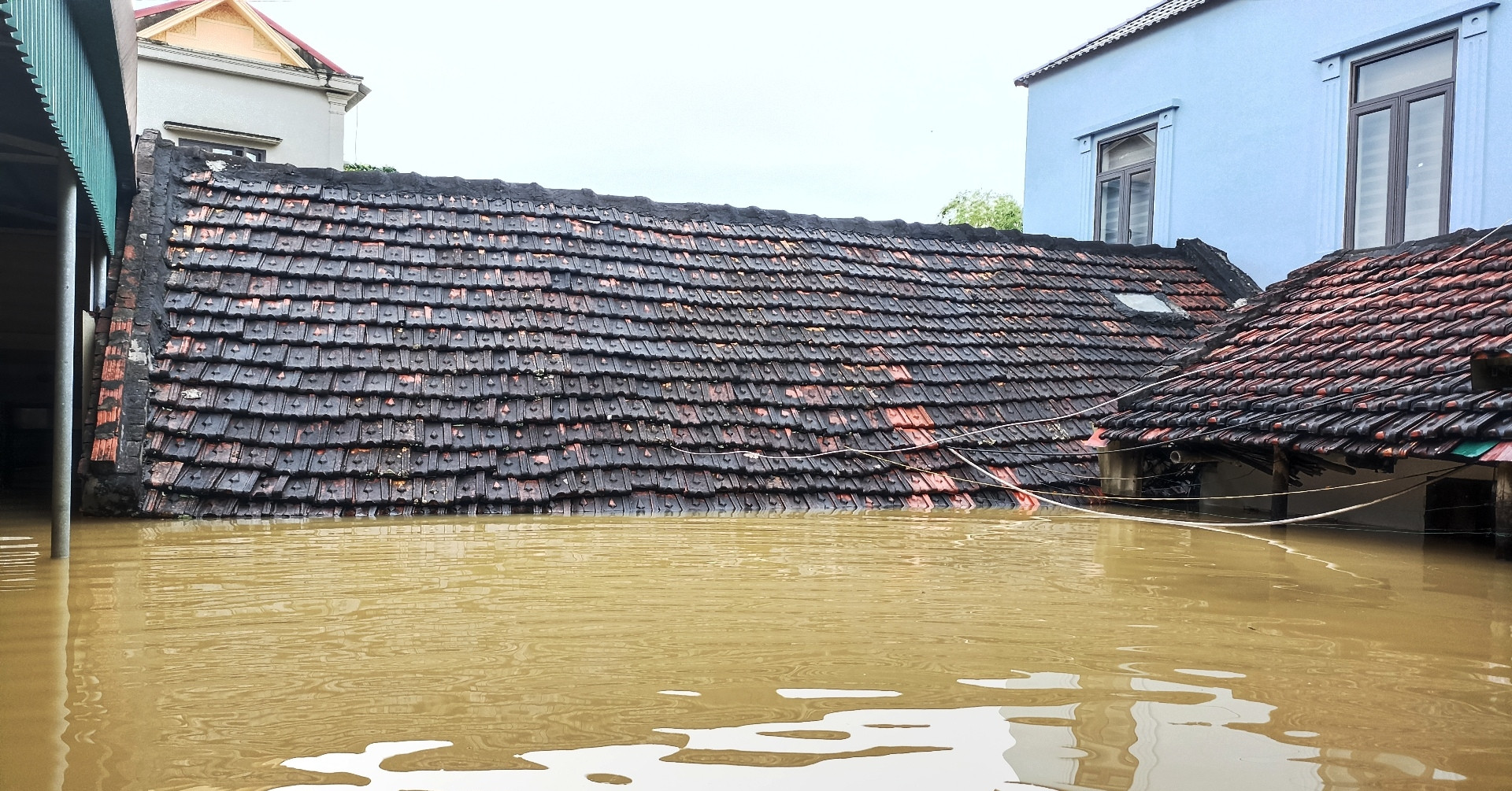
The unfolding crisis highlights the vulnerability of populations residing outside major river dikes, where sudden inundations have transformed entire villages into submerged, disconnected enclaves.
Scale of Inundation: Nearly 3,000 Residents Affected
According to rapid assessment reports released by the Steering Committee for Civil Defense and Disaster Prevention of Ninh Binh Province, approximately 3,000 residents living outside the main dike systems have been directly impacted by the severe flooding. The worst-hit areas span multiple communes and wards, including Gia Tuong, Gia Vien, Phu Son, Gia Lam, Thanh Lam, and Phu Van.

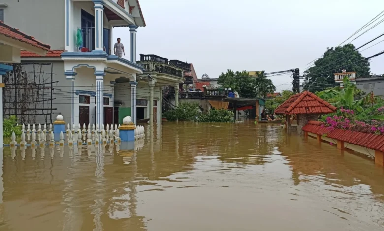
In Gia Tuong Commune, the situation is particularly critical. Nearly 800 residents living outside the Hoang Long River dike in villages such as Cao Thang and Lien Phuong find themselves completely isolated by floodwaters surging more than two meters deep. Many level-4 residential homes—typically single-story structures common in rural Vietnam—are submerged nearly up to their roofs. Residents have been forced to orchestrate emergency relocations, moving livestock, poultry, and essential household appliances onto makeshift bamboo rafts, upper mezzanines, or neighboring multi-story structures.
Similar scenes of isolation are unfolding in the island-like residential pocket of Kênh Gà in Gia Vien Commune, where roughly 600 people are cut off. Trapped families have had to hoist motorbikes and heavy equipment onto elevated platforms or transport them to the safety of the Hoang Long riverbanks before roadways became completely impassable.

Chronology of the Crisis: Fast-Rising Waters Caught Residents Off Guard
The disaster unfolded rapidly, catching many local families with limited time to prepare. According to local accounts, the severe weather event began escalating significantly around the morning of September 16, when continuous heavy precipitation upstream combined with massive discharges from the Bui River forced the Hoang Long and Day rivers past critical danger thresholds.
Mr. Phạm Văn Thành, a 70-year-old resident of Gia Thuy village in Gia Tuong Commune, recounted the swift onset of the disaster. "Starting on the morning of September 16, the river water began rising at an alarming rate," Mr. Thành noted. "My wife and I had to rapidly elevate our belongings, placing food and valuables onto cement boats. Because our level-4 home was completely flooded, we had no choice but to abandon the ground floor and take refuge at our son’s multi-story house nearby."

For elderly residents like 75-year-old Mr. Lã Văn Tỉnh, also from Gia Tuong Commune, seasonal flooding is a familiar yet increasingly taxing ordeal. Mr. Tỉnh explained that local households residing in the floodplain typically must endure five to six flooding episodes annually. While some minor floods recede within a matter of days, major surges can trap communities for weeks or even months before water levels completely drop back to normal.
Commune-Level Impacts and Infrastructure Disruptions
The flooding has paralyzed transportation infrastructure, agricultural activities, and local commerce across multiple districts.

In Thanh Lam Commune, local leadership reported that by the morning of September 17, the villages of Tri Xuyen, Nam Cong, and Bung Lang were entirely cut off due to surging water levels, with Bung Lang emerging as the most heavily inundated pocket. While municipal authorities are still compiling comprehensive damage assessments, rapid-response inspection teams have been deployed directly into the flooded zones to evaluate structural integrity, assist stranded households, and document immediate losses.
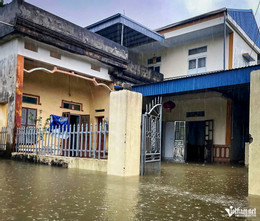
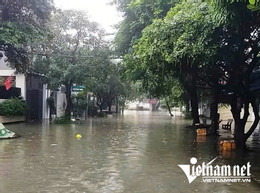
In Phu Van Ward, preliminary statistics indicate that roughly 700 residents are grappling with sudden urban and residential flooding. Major thoroughfares and residential quarters have been swamped by overflowing runoff, severely disrupting vehicular mobility and pedestrian safety.

Meanwhile, in Quy Nhat Commune, rising river levels have spilled over into low-lying school campuses, submerging playgrounds and classrooms under 60 to 70 centimeters of water. The disruption has forced temporary halts to educational activities and deeply impacted neighborhood routines. Aquaculture and agricultural sectors have also absorbed heavy blows. Although fish farmers proactively strung protective netting and reinforced pond boundaries to mitigate potential stock losses, vast swaths of aquatic farms, crops, and vegetable plots remain completely submerged as water levels refuse to recede.
Meteorological Context and Regional Vulnerability
The current flooding in Ninh Binh is not an isolated meteorological event but part of a broader regional hydrological crisis affecting northern and north-central Vietnam. Heavy monsoon rains fueled by persistent low-pressure systems have dumped hundreds of millimeters of precipitation across the catchment areas of major river systems.
The Bui River, which serves as a major tributary feeding into the Hoang Long and Day river basins, has experienced historic highs. Upstream water accumulation has forced rapid runoff downstream, overwhelming natural drainage capacities and threatening low-lying agricultural plains. Similar emergency measures have been triggered in neighboring provinces, such as Thanh Hoa, where water levels along the Song Đặng (Dang River) breached Alarm Level 3, forcing frantic midnight evacuations and emergency dike-patrolling operations.
Hydrological experts emphasize that geography plays a decisive role in Ninh Binh’s susceptibility. The province features intricate networks of limestone mountains interwoven with low-lying floodplains and dense river systems. While dikes protect the vast majority of urban centers and intensive agricultural lands, communities residing in "ngoài đê" (outside-the-dike) zones serve as natural overflow basins during extreme weather events. These areas absorb the initial kinetic and volumetric energy of overflowing rivers, protecting major regional infrastructure at the direct expense of residential homes and livelihoods built on the floodplains.
Emergency Response and Outlook
In response to the escalating crisis, the Ninh Binh Provincial People’s Committee and the Provincial Command for Natural Disaster Prevention and Search and Rescue have maintained high alert statuses. Local authorities have mobilized police, military personnel, and militia units to assist with evacuations, distribute emergency supplies, and patrol fragile dike segments.
Boats, canoes, and specialized rescue vehicles have been dispatched to isolated communes like Gia Tuong, Thanh Lam, and Kênh Gà to ensure that medical emergencies can be addressed and vulnerable populations—including the elderly and young children—can be reached.

Despite these relief efforts, weather forecasts indicate that rain will likely persist in the coming days. With upstream water from the Bui River continuing to feed into local systems, hydrologists warn that water levels on the Hoang Long and Day rivers will remain dangerously high, keeping thousands of residents in limbo as they wait for the floodwaters to peak and eventually recede.